

Cathedral Caves
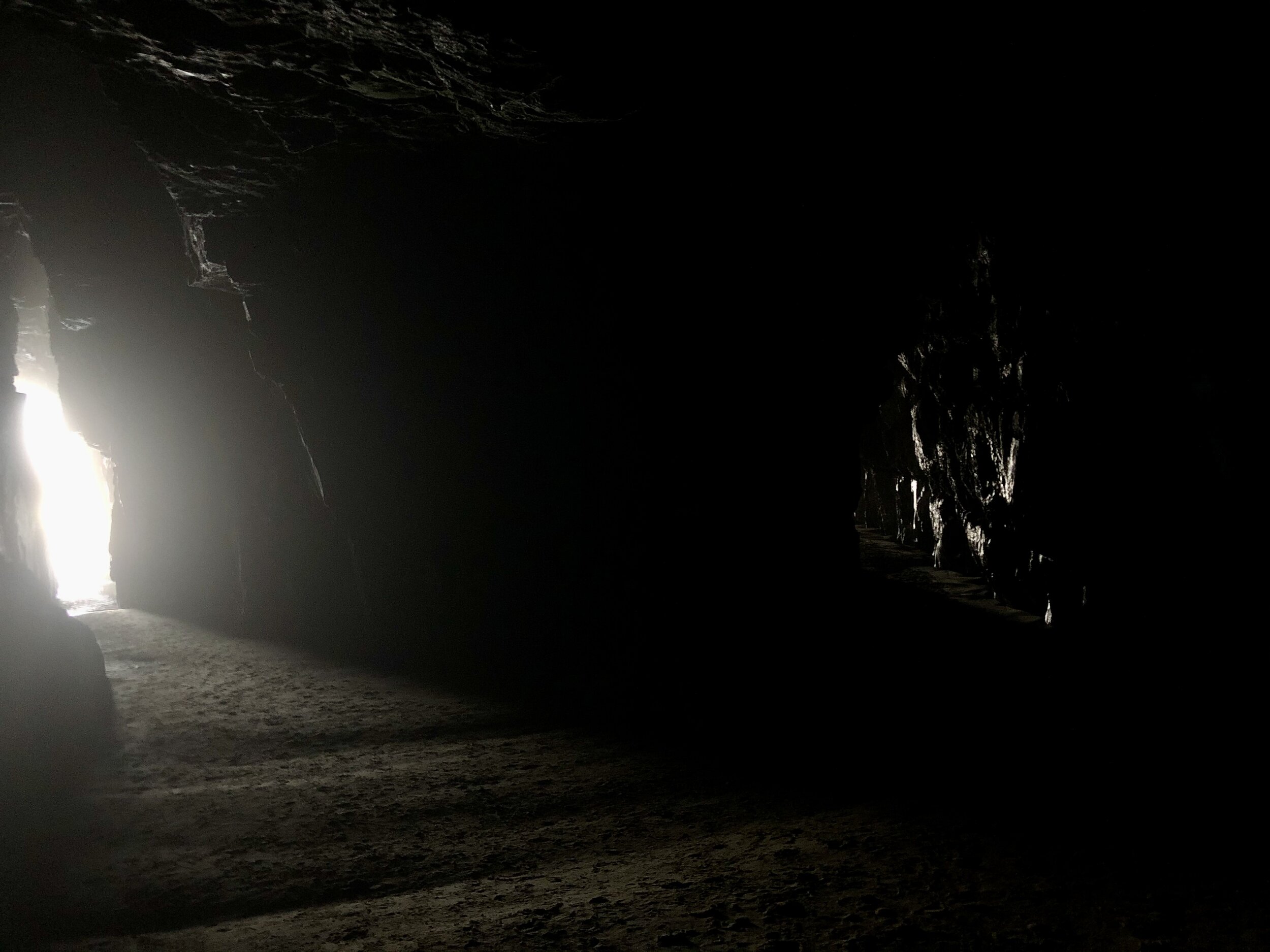
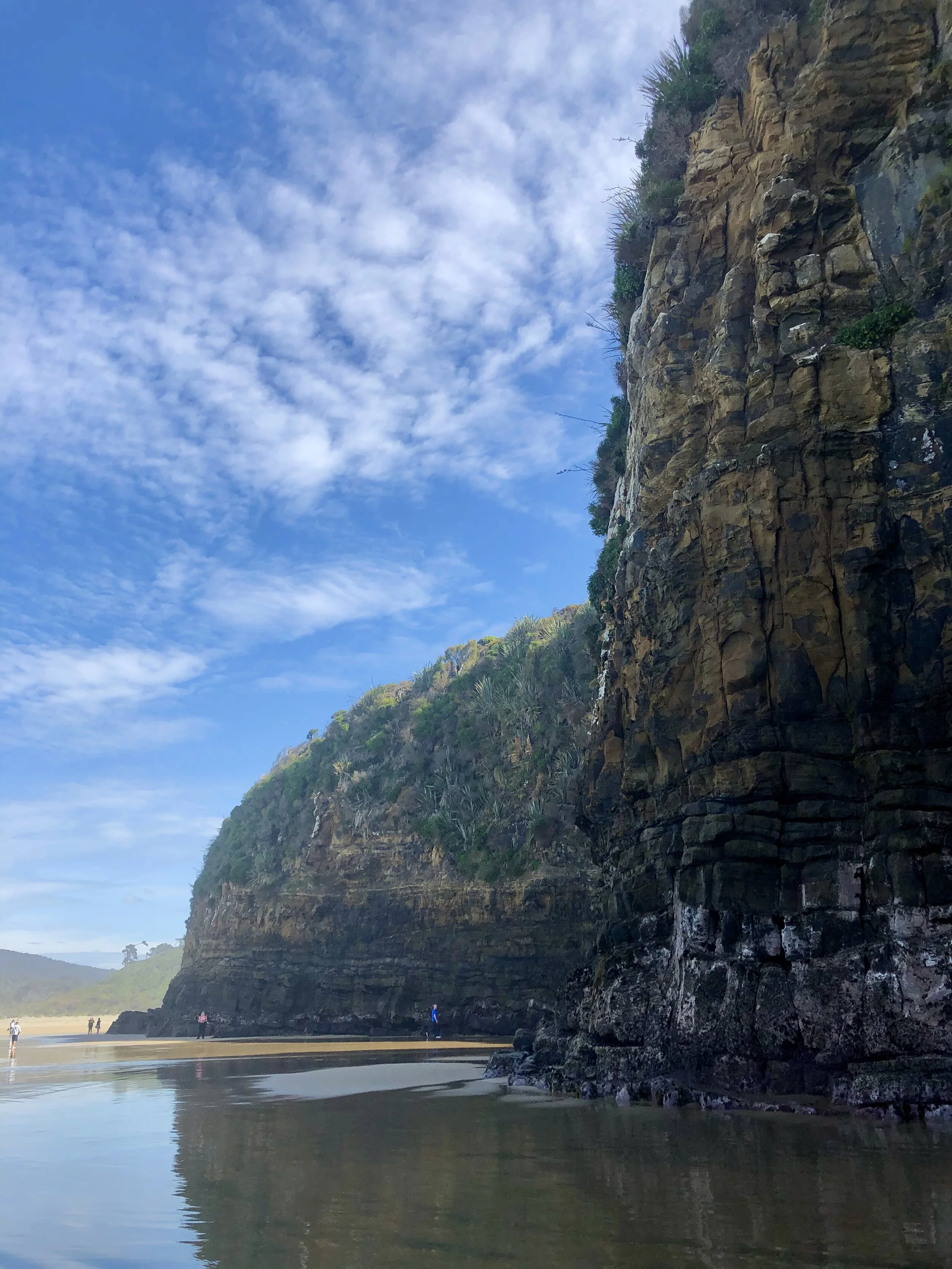
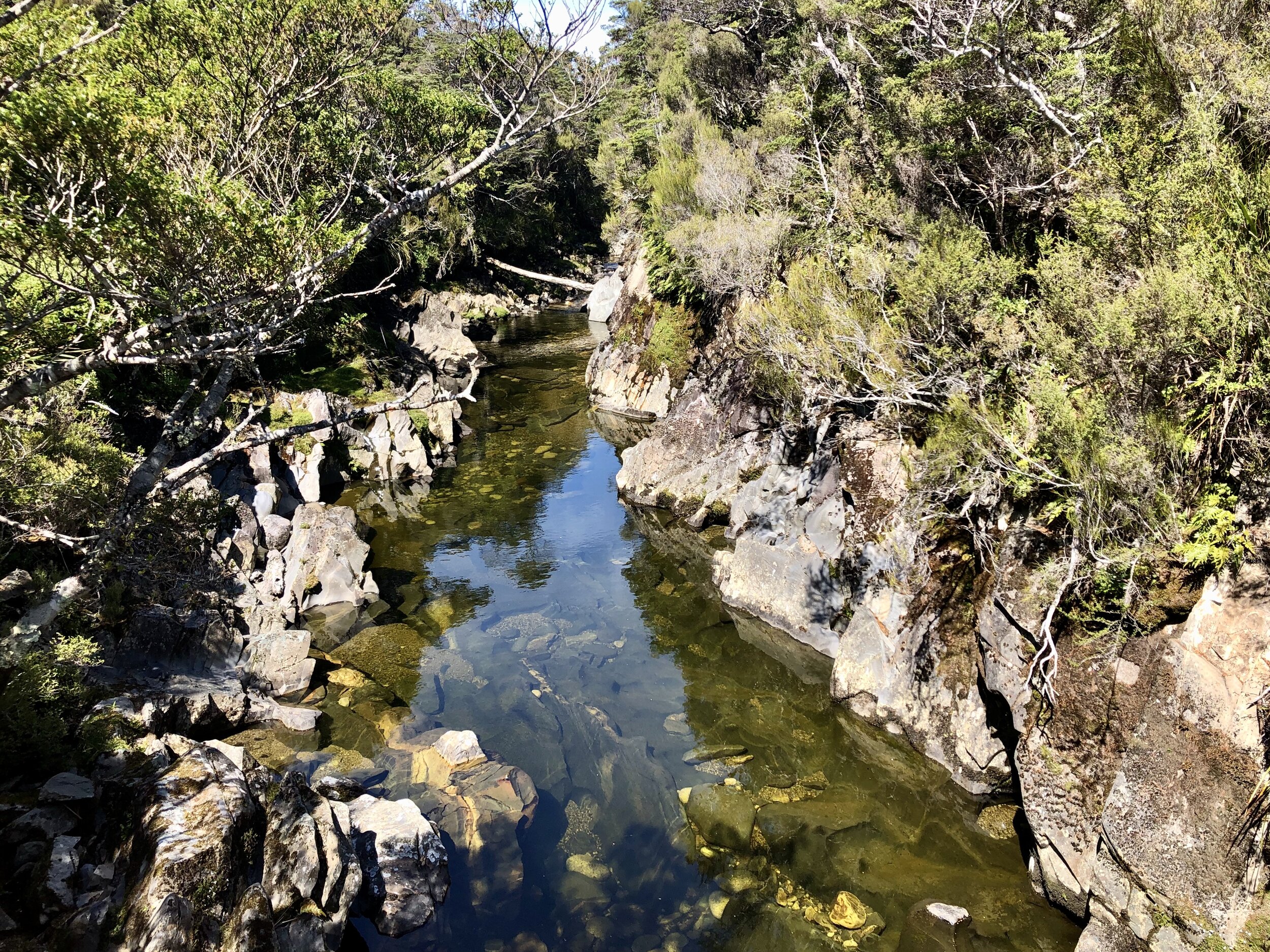
Cathedral Caves left me out of breath. In part because of their beauty, but also because 45 minutes were spent sprinting from cave (cathedral) to cave (cathedral) before the tide began to advance. These massive limestone caves are known for their acoustics (dream: an orchestra playing right where I stood in the image below, or perhaps the chanting of Gregorian monks, or the strum of Joanna Newsom’s harp). And indeed, they are reminiscent of old European cathedrals: long, narrow rooms with massive arched ceilings. Altogether, they add up to nearly 200 meters (656 feet) deep and roughly 40 meters (100 feet, or slightly less than 10 stories) high. The caves are only accessible for 2 hours before and after low tide. On this particular day, low tide was at 11:06am, and the carpark closed at 1:15pm. It is about a 1 km hike to get to the beach area, so after arriving around 12:00pm, the tide was already beginning to advance. The race was on!
There are two main caves that most tourists find. BUT, just beyond a rock outcrop, there are even more caves! And then beyond another rock outcrop, there are even MORE caves! [Cut to scene of me sprinting through thigh-level water as it crashed against the rocks and I struggled to keep secure footing.] The most esteemed guidebook, NZ Frenzy, told of wonders beyond the original two caves. I was looking for some magical penguin den (!that I would stay at least 10 meters away from!), or an inner-cave waterfall. But nay! However, there was a cool little trickle of water (see 2nd to last cave picture). And it was fun to sprint as the water receded and then stay perfectly still and brace myself as the water rushed again over my ankles and up my legs. I’m living proof that I survived.


It is worth noting that Cathedral Caves are on "Māori land”. As with many countries colonized by Europeans (and in the case of NZ, largely British subjects), the native people were tricked out of their original land, only to be given the leftover bits of the least desirable parts of the country - the places where it was difficult to make any living off the land (think Cherokee in Oklahoma or Navajo in the four corners region of the US). The Māori too were allocated land that had no real agricultural or economic value, as mentioned by the Cathedral Caves website:
“At the turn of the 20th century, the New Zealand Government decided to reserve land for descendants of Māori who had been adversely affected by Government and private land purchases in the 1840s and 1850s. The South Island Landless Natives Act (SILNA) 1906 was intended to provide redress for the economic hardship afflicting Māori who had lost their customary lands and the means to support themselves. Under the legislation, the Government (Crown) allocated 57,500 ha of land, much of it in southern South Island and Stewart Island, to about 4,000 Māori. At the time of their granting, these SILNA lands were among New Zealand’s least valuable – remote, rugged, wet, unsuitable for farming and often far from traditional home areas.”

Now, the land given to the 4,000 Māori individuals has been divided up into parcels. Precisely 234 Māori descendants own a claim to this particular piece. The highlighted bits in the below image are the particular section encompassing Cathedral Caves.

The 6 highlighted sections make up the “Tautuku Block X Section 3C Trust,” which the 234 Māori have a stake in.
It is worth nothing that the division of the government that oversees the Māori land is the Ministry of Justice…
New Zealand likely has had the most civilized response to their oppression of native people that I have seen anywhere in the world. That is not to say it is perfect. And it is not to excuse the actions of the European settlers. But yet, New Zealand seems like it is actually really trying, and has been quite successful at making amends with the native Māori. For instance, there are dual language signs nearly everywhere you go. “Kia ora” is a common greeting said just as frequently among white people (and is not considered cultural appropriation). Which leads me to consider the next logical question: what if the US took Native American language and culture as seriously as it did European heritage? There is a feasibility argument here: America had hundreds (thousands?) more tribes than New Zealand, with vast linguistic and cultural differences, and to include them all in the mainstream (e.g. dual-language signs, honoring sacred areas) would be nearly impossible (in part because many of those areas no longer exist). But what might be even better? To consult with the descendants of those Native Americans that the US relegated as out-of-sight/out-of-mind. To ask them what they want and what they need. Why New Zealand appears in such stark contrast with the US is simple: NZ chooses to ask and listen to the people whom it has suppressed for over a century and work toward progress (yes, ever-imperfect, but an open dialogue nonetheless).


The trail leading back up to the carpark.
At any rate, I suspect that no matter who you are or whether or not you know the feel of an ancient European cathedral, you are left with a sense of awe at the cavernous possibilities that crashing waves can create, including a moment to catch your own breath.

Kepler Track: Part III
Day 4: Moturau Hut to Rainbow Reach (6 kms).


Spirit Lake


Waiau River (and also the place of filming for the Anduin River in Lord of the Rings)


Waiau River pt. 2

Probably the best cautionary sign I’ve ever seen.

Finally on the road back to rest.

Kepler Track: Part II
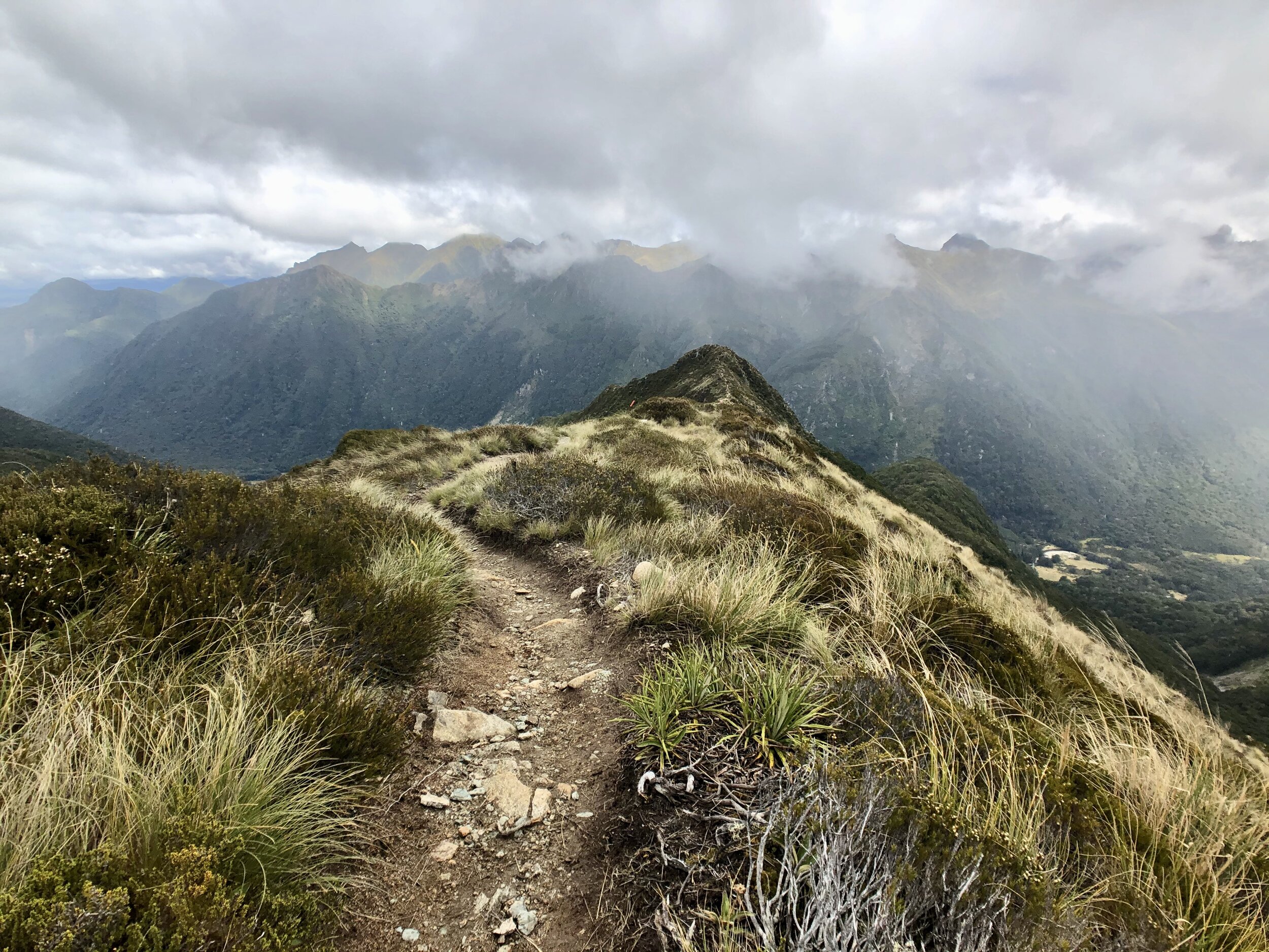
Day 2: Luxmore Hut to Iris Burn Hut: 14.6 kms (8.9 miles).
*Note: a burn comes from a Scottish/Northern English word for a small stream; a brook. Since NZ was colonized by folks from Great Britain, a lot of these words are still present today.

On Day 2 of the hike, after climbing to the summit of Mt. Luxmore, we were greeted by a kea, the world’s only species of alpine parrot! Many of the kea in this area are banded, and if you can see or get a picture of a kea with its band, you can upload it to a database called www.keadatabase.nz, where a team of volunteers will parse through photos and record observations. This king of the mountain is named Shae and was banded only last summer (July 2019). He’s commonly seen around Luxmore Hut as well!
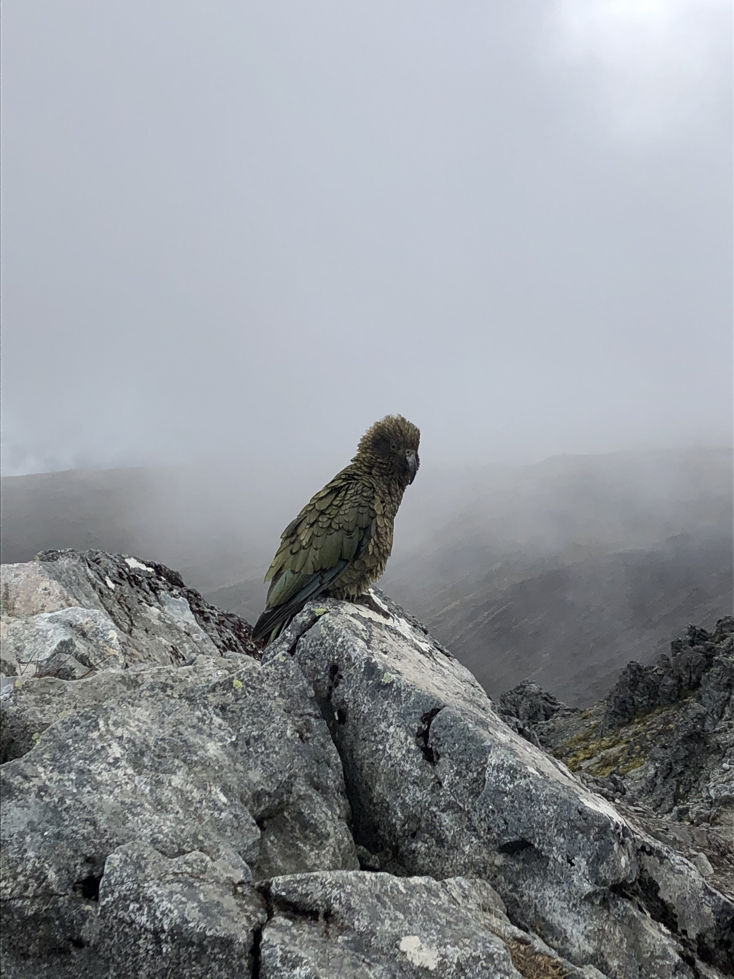
In total, I counted 10 kea along the trail. Shae was the only individual that I could see was banded, but I still recorded all my other observations. The cutest kea are the juveniles, in my opinion. Even though they are as large as their parents, they have bright yellow rings around their eyes and squawk and follow their parents around helplessly.

Kea adult in foreground and adolescent in background. See the bright yellow ring around its eye?


Day 3: Iris Burn to Moturau Hut: 16.2 km (9.8 miles).
For some reason I took almost no pictures on this stretch. It was beautiful though, mostly mossy forest.

Kepler Track
Just finished the Kepler Track yesterday, another one of the Great Walks of New Zealand. To be honest, it was probably the most beautiful hike (er..tramp) of my life. Instead of talking too much about it, I will let the pictures speak for themselves.
Total length: 60km (37.7 miles)
Total elevation gain: 2,215 meters (7,270 feet)
(counter-clockwise loop)


Lake Te Anau

First night’s hut, Luxmore Hut! Look how crazy this view from the hut is.
Stay tuned for more Kepler images soon!

The Remarkables
Less than 2 kilometers outside the city of Queenstown, New Zealand, there is 13.5-km winding (and in some places white-knuckle-inducing) road with incredible vistas of Lakes Hayes and the ice blue Kawarau River. At the top is the Remarkables Ski Resort, a well-known place to ski in the winter months. Right now, there is not a hint of snow on the ground, which makes it a perfect time of year to hike around the slopes.
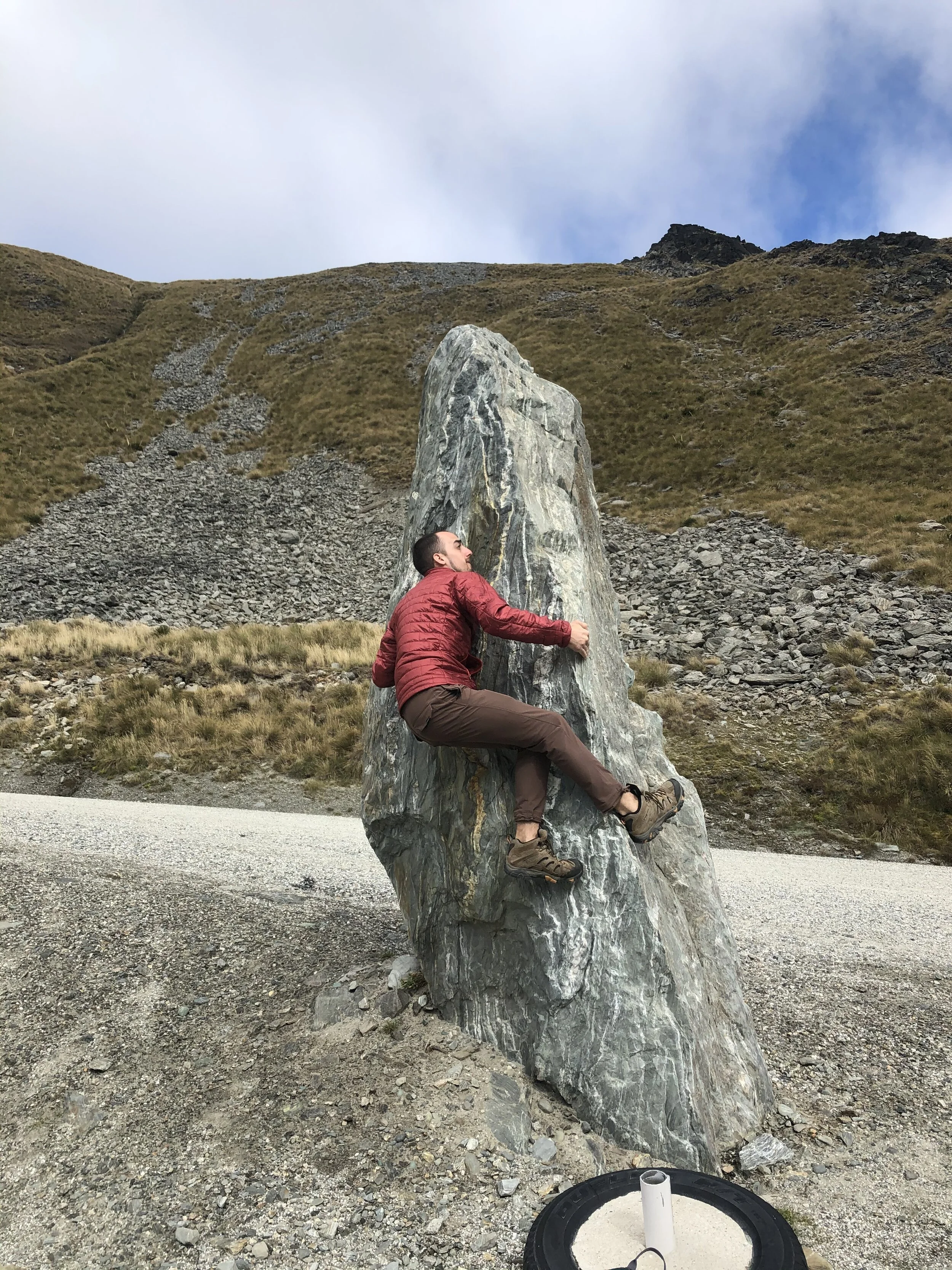
Willie leaves no rock unclimbed!


The vertical hike up to Lake Alta.

Lake Alta, a cirque alpine lake (meaning a carved bowl-shaped from a glacier).

Angela with a celebratory beer for making it to the lake!
We saw some pretty incredible plants on the way up, too. Hardy creatures for such a cold, high, dry altitude!

Hectorella caespitosa


Epilobium porphyrium

Sigaus australis (alpine grasshopper)


Who needs a trail when you can irresponsibly scramble up scree?

The view at the top!

And then you must scramble down.

Somehow we managed to scramble down this without incident.

The lodge from above.
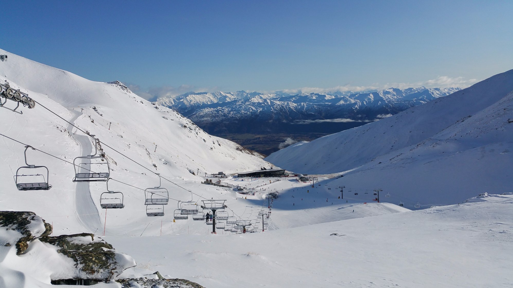
The same lodge in the winter! Photo by Mark H. from TripAdvisor.

Heaphy Track: Part II
Day 3: James Mackay Hut to Heaphy Hut


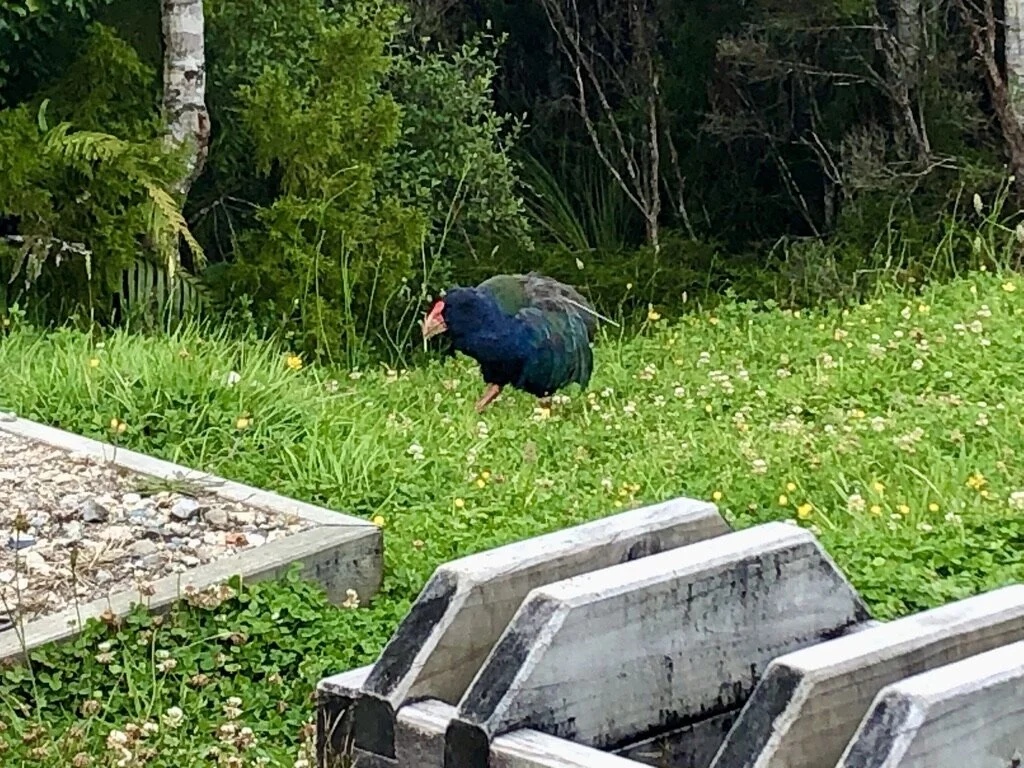
Okay SO. This bird is exciting. It is called a takahē (Porphyrio hochstetteri) and looks sort of like a very large colorful chicken with a bright red beak (this was as close as I could get to one, so the image quality isn’t great). They are flightless birds, so once again, have little precaution against humans or human-introduced predators. In the late 1800s the “last” one was caught. They were presumed to be extinct for 50 YEARS until in 1948, a local man out for a tramp (see definition in previous post) stumbled upon one in the wild. Can you imagine being that dude? It would be like seeing a unicorn. After its rediscovery (future searchers found 2 birds), the part of Fiordland park in which they were found was closed off to people in order for the takahē numbers to rebound. Unfortunately, by the 1980s, their numbers were still only a little over 100. The DoC intervened with targeted breeding programs (located at Te Anua, which I will be visiting next week!) and the population has now increased to about 400 individuals. In 2018, 30 adult takahēs were introduced near the Heaphy Track in Kahurangi National Park (specifically Gouland Downs, where this photo was taken). This past week, on the track itself, I saw 5 of them!!! That’s 1/6 of the whole population!! This is the first wild population outside the remote Fiordland Murchison Mountains where they were originally rediscovered. All 30 birds are closely monitored and only one has died of natural causes. Next step will be to see how the breeding and survival rate of chicks goes! If it is successful, it will be major.
Damn. Now that’s a conservation story.
Read more here: Wild takahē return to Kahurangi National Park


And finally, the view from the Heaphy Hut!

Where the Heaphy River meets the ocean.
Day 4: Heaphy Hut to Kohaihai River Mouth (16.2 km) and the disintegration of my character (distance unknown)

Day 4 was spent entirely along the Pacific coast, but this is the day I finally broke. What should have taken 5 hours to finish took nearly 7, and my bent-over dry-heaving on the trail caused alarm in some fellow trampers, who alerted a park ranger who came and literally carried my backpack the rest of the way (maybe 2 kms). Ashamed? Yes. Relieved? YES. Made it to the bus on time? YES!
I’m not sure what did me in. I don’t think it was water contamination. It was probably overexertion from carrying a bag with all my worldly possessions plus a lack of sufficient calories that created a problem I have experienced as well in my last 2 trail runs (though calories weren’t the issue there, I don’t think, nor was the pack). Who knows? Something to keep an eye on.
But look at these views!


The end is nigh!

Heaphy Track
The past 4 days and 3 nights were spent on the Heaphy Track, one of New Zealand’s “Great Walks,” 10 well-maintained tramping (hiking) and mountain-biking trails throughout both North and South Islands.
[Note: I was a little confused by this, but I think tramping and trekking are the same thing. Tramping is the New Zealand-specific word for “a person who walks for long distances in rough country for recreation,” (i.e., a crazy person). Trekking, according to my Apple dictionary, means to “go on a long arduous journey, typically on foot.” A hiker is a tramper’s littlest brother, as hiking simply means, “the activity of going for long walks, especially in the country or woods.” Nothing about rough country in that definition!]
AND TRAMPING IT WAS.
The km/miles/distances seemed to be a little wonky, so above is a real GPS map (not recorded by me, my watch died in the midst) of the entire Heaphy Track, beginning at Brown Hut and ending at Kōhaihai Shelter. The last 1/3 of the trek was right along the Pacific Ocean, which was a welcome site after a grueling few days. Those sandflies, though… I just want to put a quote here from the OG captain (OC), Cpt. Cook, when he explored this area many moons ago, 1773:
The most mischievous animal here is the small black sandfly which are exceedingly numerous and are so troublesome that they exceed everything of the kind I ever met with, wherever they light they cause a swelling and such intolerable itching that it is not possible to refrain from scratching and at last ends in ulcers like the small Pox.
Indeed, they are itchier then mosquitoes and really get you around the ankles. The only way to avoid them is to not stop moving, which makes stopping to catch your breath or appreciate the scenery a little tricky. However! I have discovered a miracle potion called “Bonjela,” a NZ mouth ulcer remedy that is supposed to work wonders on itchy sandfly bites? I am going to get some at the next pharmacy or supermarket I see.
And now,
Day 1: Brown Hut to Perry Saddle Hut (17.5km)

The Heaphy takes a little bit of planning. This shuttle got us from Nelson, NZ on the northern coast to the Brown Hut parking lot (about a 4 hour drive including some other stops), then another bus picked us up at the end of the Heaphy and dropped us off at Westport (about a 2 hour drive). Some people then took another bus back to Nelson, which makes for an insanely long day.


Day 2: Perry Saddle Hut to James Mackay Hut (24.2km)

In the above image you can see a small box on the bottom right corner. This is a stoat trap with poison bait. Don’t look up a picture of a stoat (Mustela erminea + 2 other species) — they are way too cute. They were introduced in the 1870s as a way to control the rabbit population, and while they did a good job of that, they also managed to hunt many bird species to extinction or near-extinction. There has been a massive effort to cull the stoat population in the national parks areas, which these chemicals help achieve (also known as 1080). Introduced rats (ship rats and Norwegian rats) have also become a nuisance, as baby birds are a favorite food source for the rats. Many bird species endemic to the islands have lost the ability to fly, thus making even easier prey to the stoats and rats. Lastly, introduced common brushtail possums have wreaked havoc on the local ecosystem. (Interestingly, possum wool is used here in combination with sheep wool! It’s advertised everywhere in yarn and clothing shops.) Possums were introduced in the 1830s to begin a fur trade. They also love baby bird snacks and the compete with native birds for leaves and fruits of trees. All in all, about 80% of New Zealand’s bird life is threatened by these three species, but the DoC (Department of Conservation) has done an excellent job of culling these introduced species and there is evidence that many bird populations are recovering. It is heartening to hear conservation success stories.


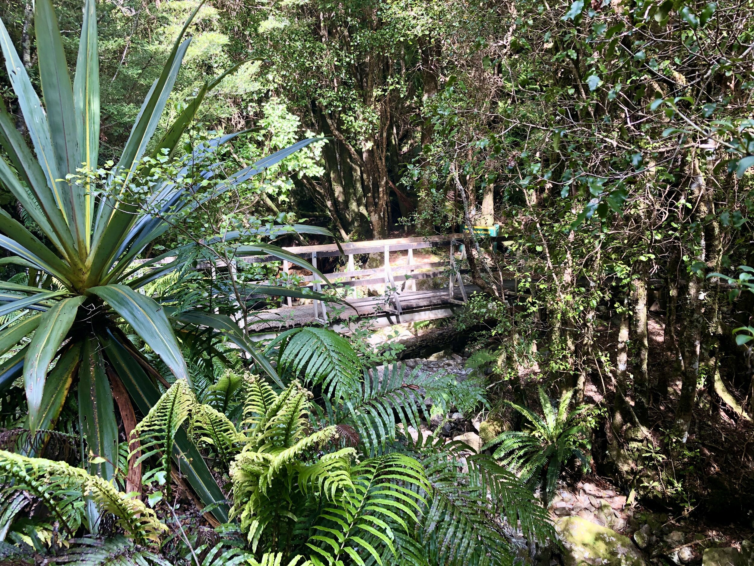
A brief respite at Gouland Downs Hut.

This is a weka bird (Gallirallus australis). They are so numerous on the trail that it’s hard to believe that their conservation status is vulnerable (one level beneath endangered), but I haven’t seen one anywhere else in NZ besides the Heaphy Track. They are sneaky little buggers. I watched one grab a woman’s cell phone and run away! (She got it back.) I watched another one grab a woman’s opened ziplock bag of snacks and run away with it upside so all the snack contents spilled out for the other weka to gobble up.

The boundary bench! Am still a little confused by this - one side (the side I am sitting on) says “West - Buller.” West refers to the West Coast Region, of the 16 total regions throughout NZ. Buller is one of the 3 districts within the WCR. The other side of the bench says “Nelson/Marl - East.” But those two eastern districts completely skip over Tasman??

Can some1 plz explain this 2me???


The huts provided by the DoC on the Great Walks are amazing. This one is James Mackay. There is no electricity, but there are bunk beds with nice mattresses, flush toilets, sinks, and gas burners to cook food with (the DoC claims you have to bring your own cooking equipment but each hut we came across had a full supply of pots and pans, sans salt/pepper/oil). Some places don’t mention that you need to bring your own lighter to light a gas strove, so that’s a little annoying, but luckily NZ’ers are a friendly and generous bunch.

A kitchen with a view!
Is this post long enough yet? I’ll save the 2nd half for later.
Cheers!

Windsong Orchard


The past seven days were spent picking blueberries in the morning, selling plums at the farmer’s market, getting to know the wonderful Crum family (+Matt & Maggie), and eating lots of delicious bread (while sipping on local Sauvignon Blanc). Couldn’t have been happier with my first WWOOF experience!


Whakapapa
Whakapapa is a Māori word for genealogy, and is also the name of a village in Tongariro National Park, which is a UNESCO World Heritage site on the North Island. It also has excellent views of MOUNT DOOOOM (a combination of Mount Ruapehu and Mount Ngauruhoe, sacred to Māori). A hike on the nearby Taranaki Track reveals resplendent plant life. If I had grown up in New Zealand, I hands down would have become a botanist. And yes, I can’t not think “Waka Flocka” when I see the name.


MOUNT DOOM (above)! Not spewing lava today.


Mount Ruapehu is above in the background (where MOUNT DOOM was also filmed).


