Arches National Park
A quick day in Arches National Park. A last minute reservation (required now, different from 10 years ago), a Park’s pass, an audioguide, and some of the most beautiful weather imaginable. The goal is to go back and do it all over again, bike around, camp overnight, and look up at the stars.

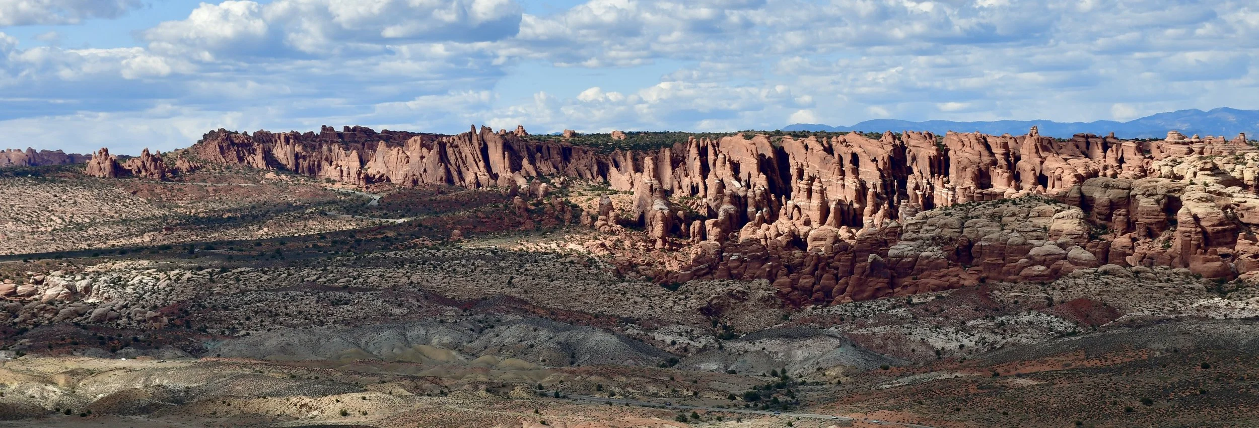
Fiery Furnace


Delicate Arch (the famous icon of Utah) from afar afield viewing area.
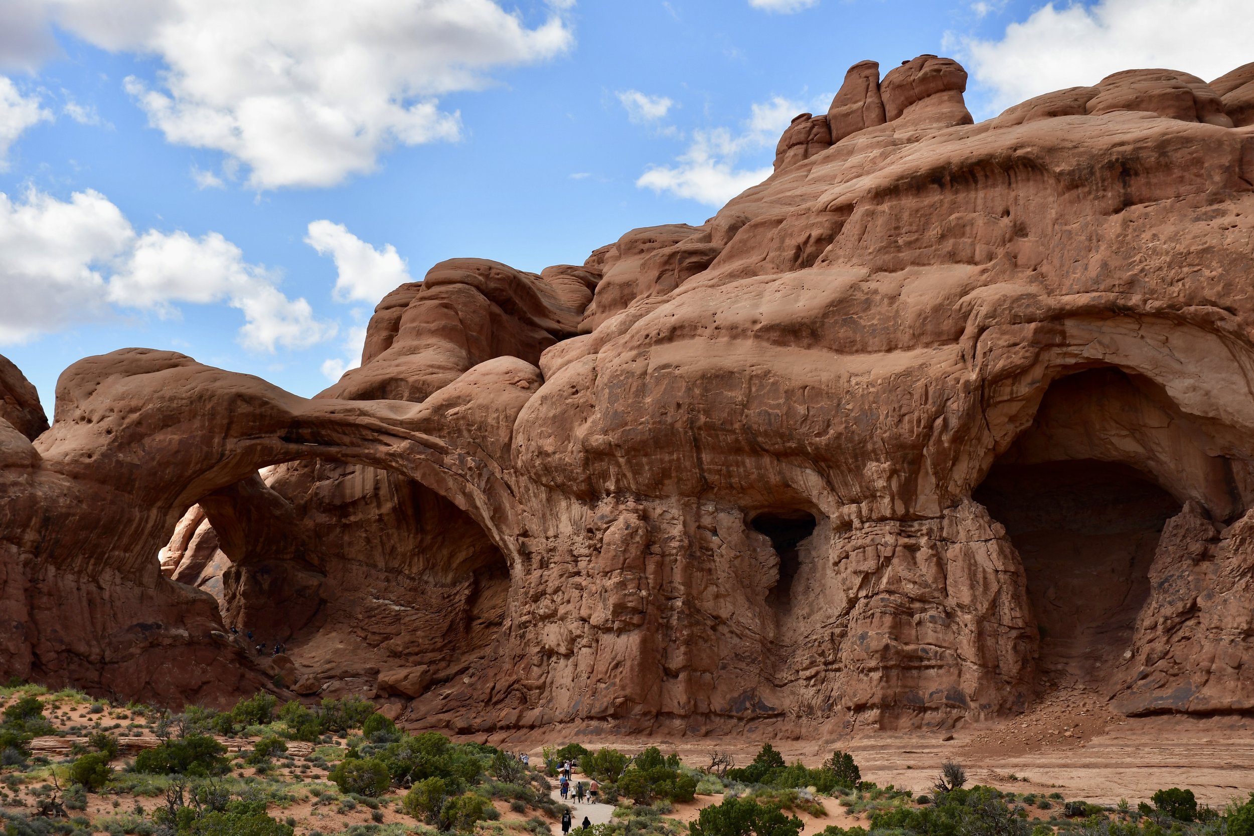
The Double Span


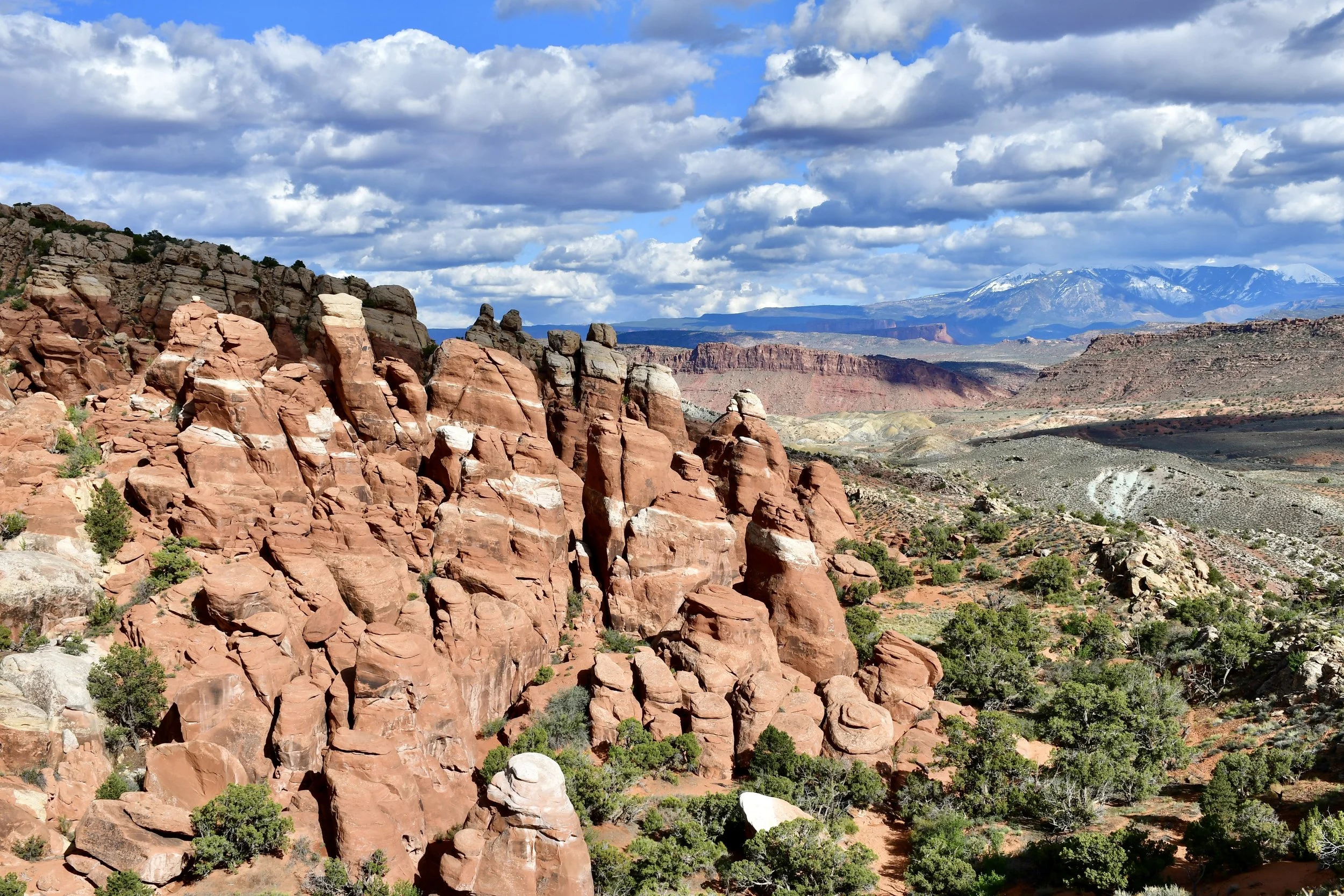
Le Sal Mountain Range


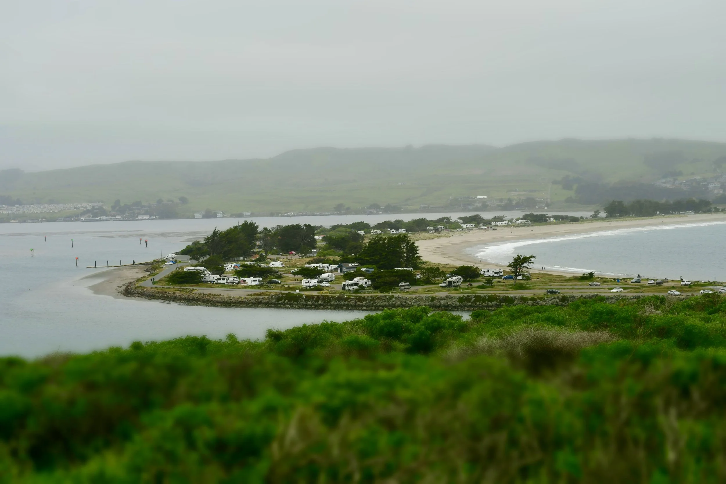
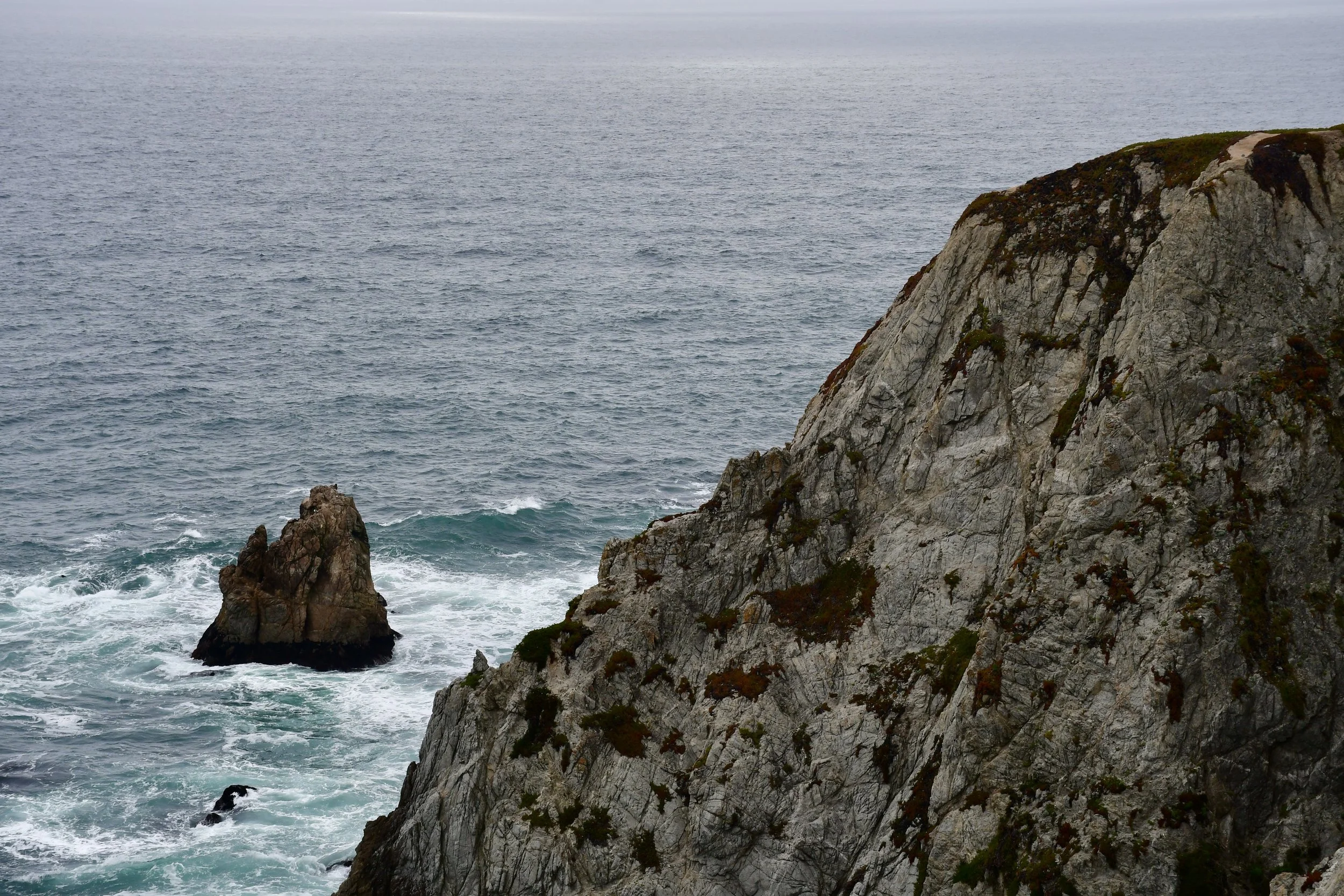
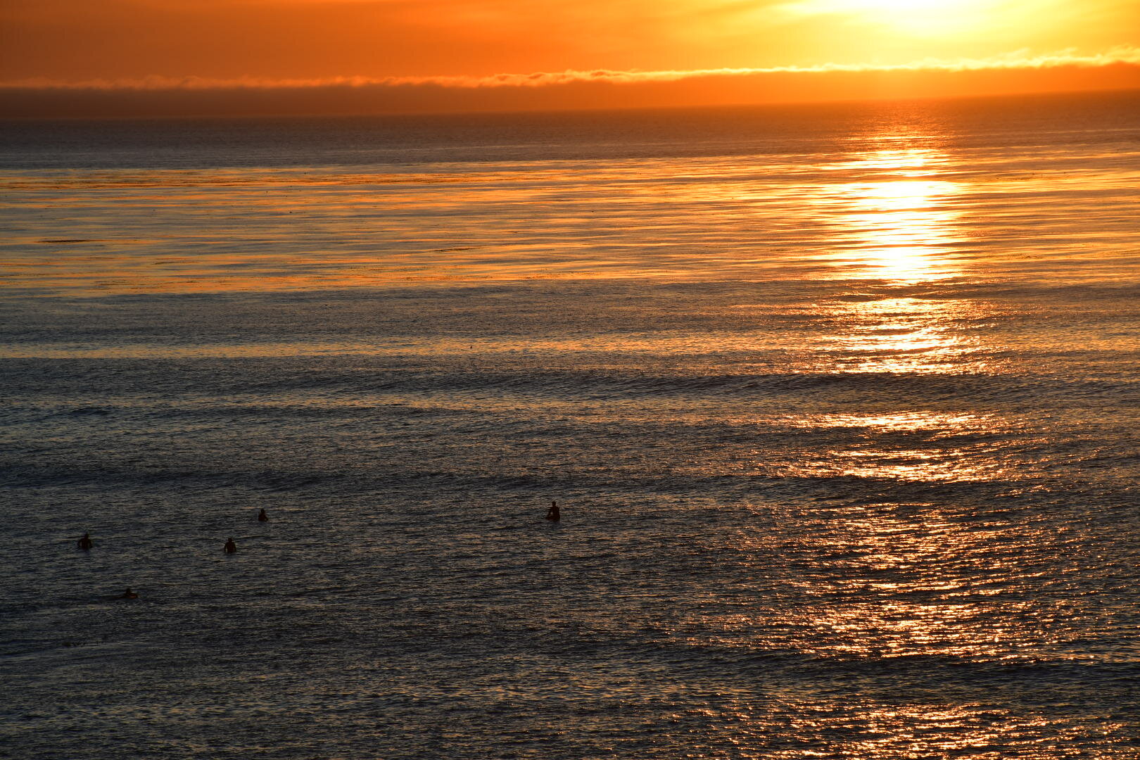
Bodega Bay
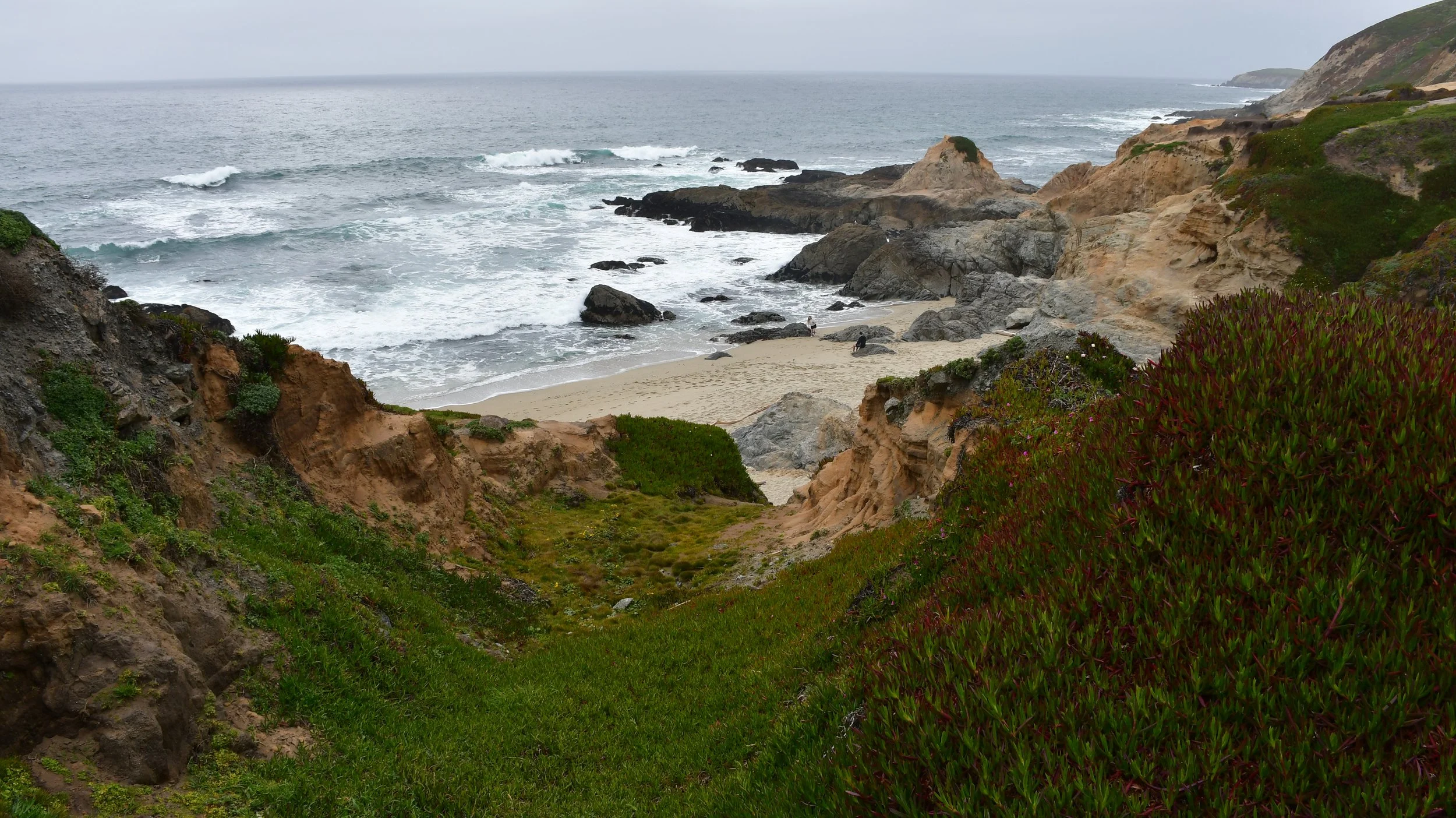
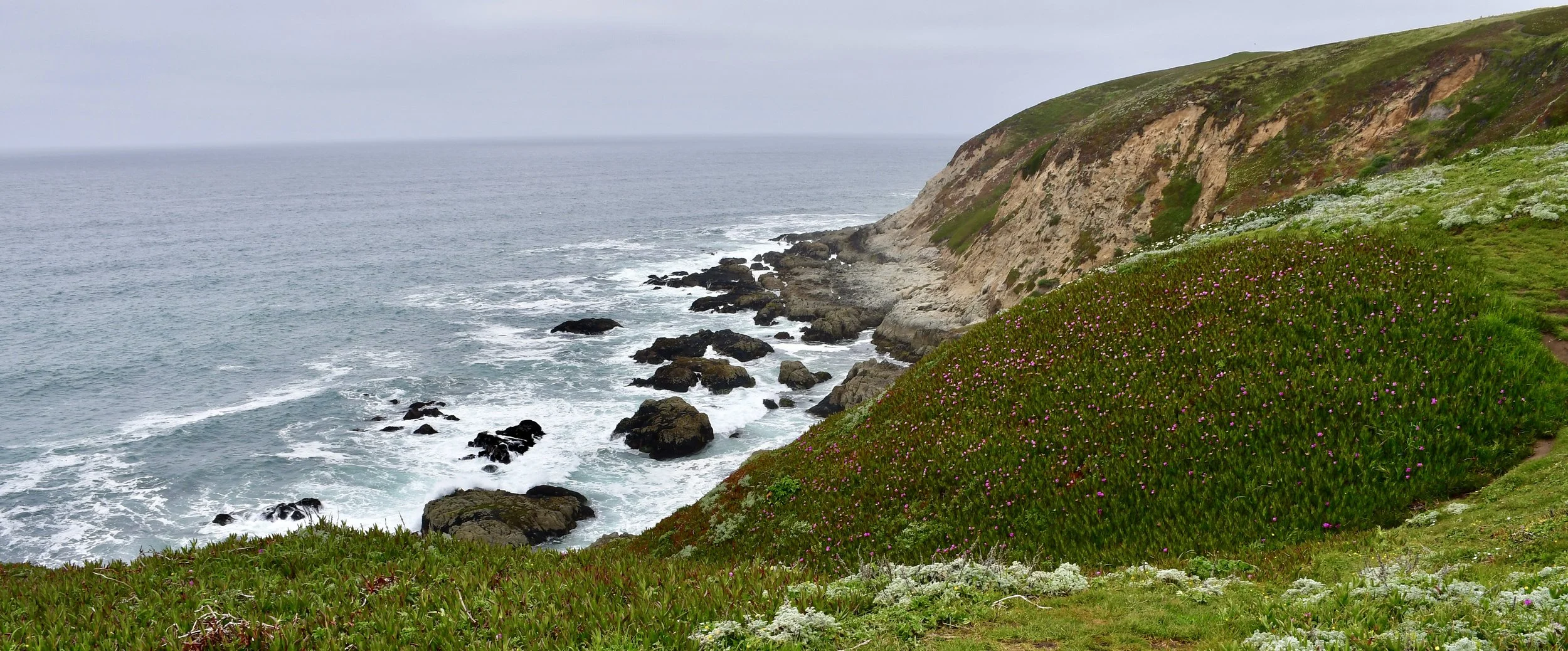
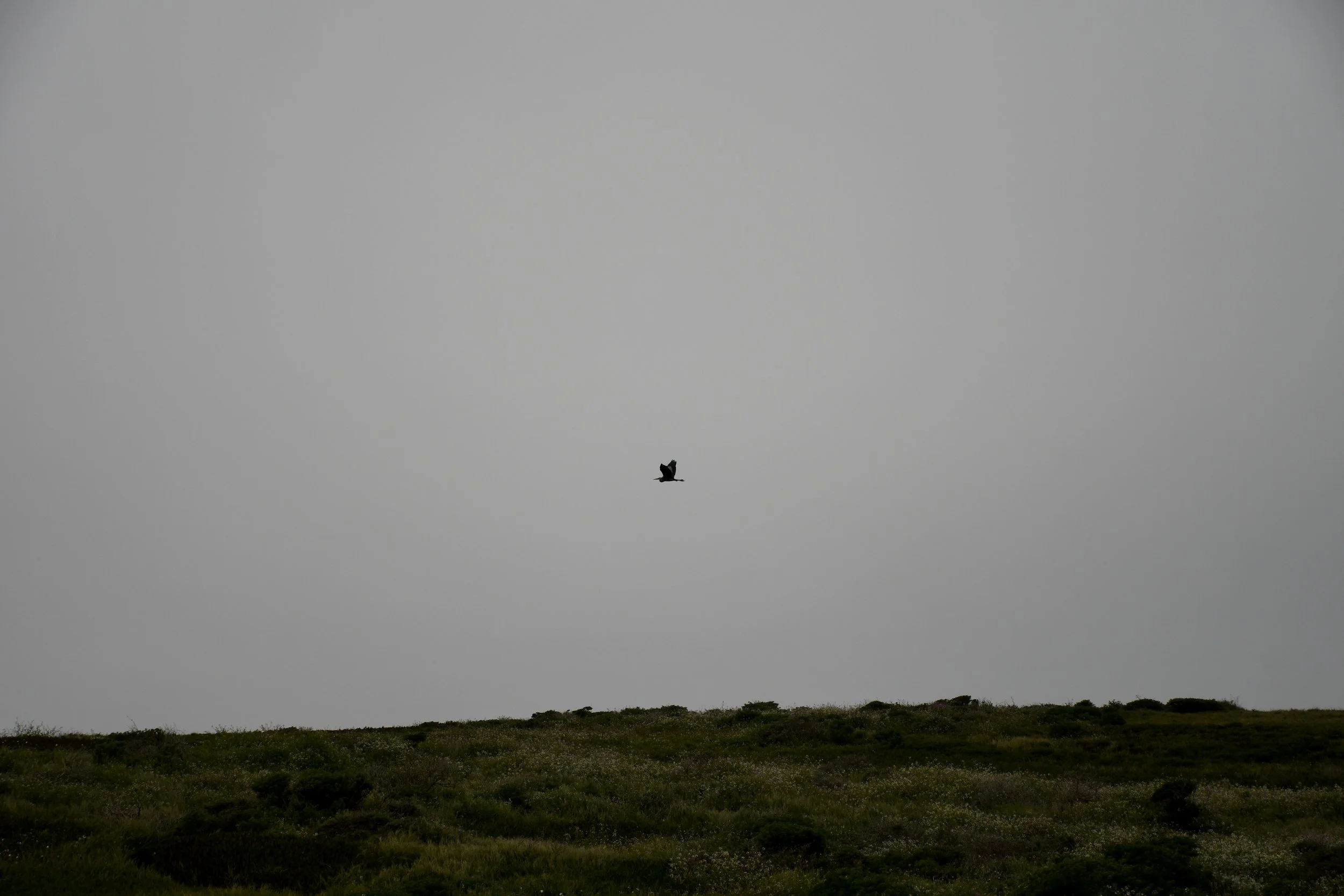
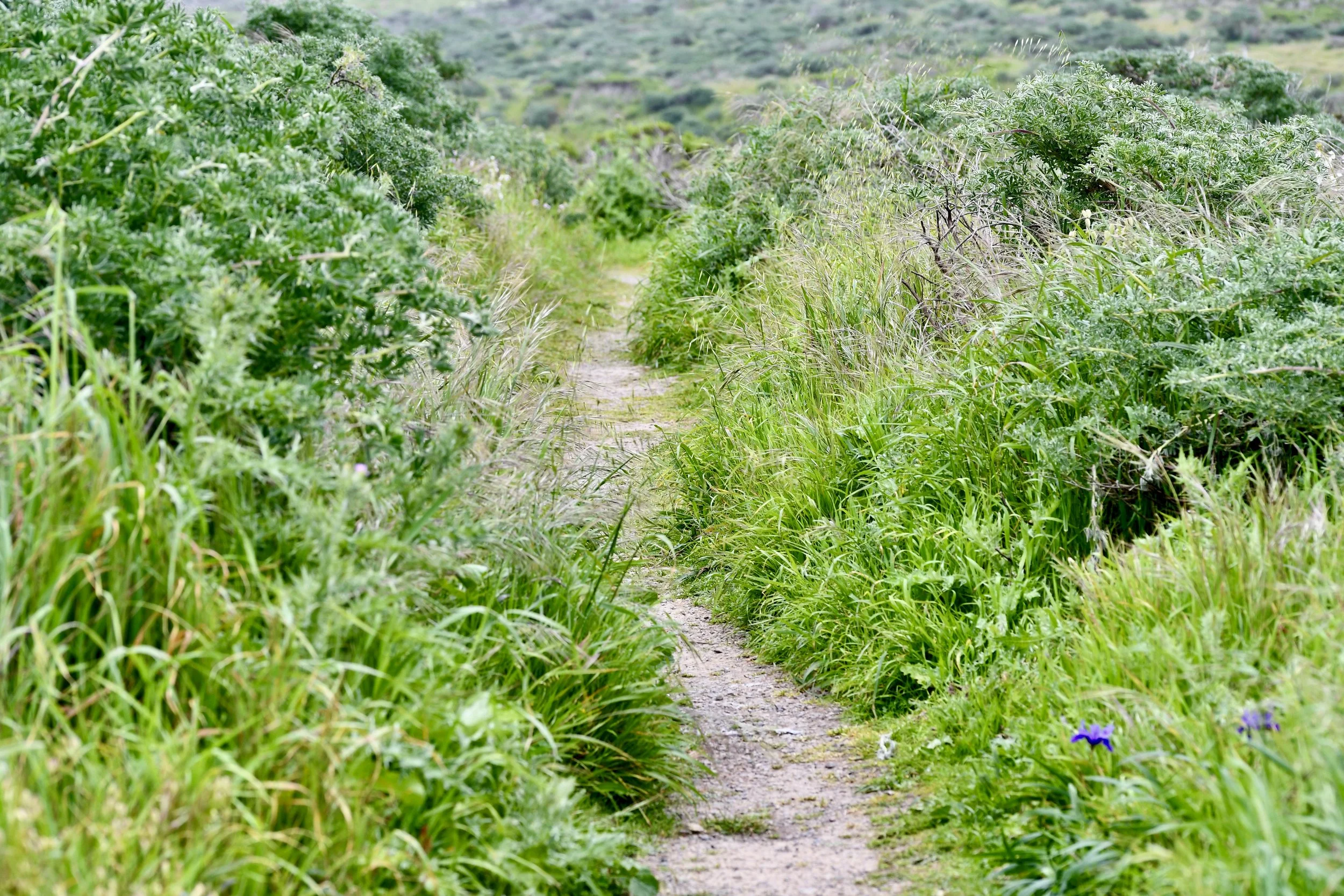
I went to Bodega Bay recently to collect some seawater off a pier for a long-term project with collaborators at UC San Diego. Somewhat of an ironic location, considering we’re studying marine algae, in the location of a famous Hitchcock movie, “The Birds,” inspired by a true story where seabirds were likely poisoned by a neurotoxin given off by a species of marine diatom. Though the actual event happened farther south, near Santa Cruz, Hitchcock chose the location of Bodega Bay because of its gloomy, foggy feel. The two days I was there were precisely that: windy, foggy, misty. I holed up for an evening at the Bodega Harbor Inn, reading from the Fall 2023 issue of “Wings,” the publication of the Xerces Society. Before, I had attempting read on the windy beach of Bodega Dunes, then found coffee (at The Birds Cafe) and tried for a walk at Bodega Head, the long peninsula that separates the Bay from the Ocean. Slow hiking-covering a short distance but taking time to stop and notice- is my bread and butter. What’s more, it was an opportunity to hike alone - without anyone there to hurry up the pace. Despite the wind, I was enthralled by the wildlife.
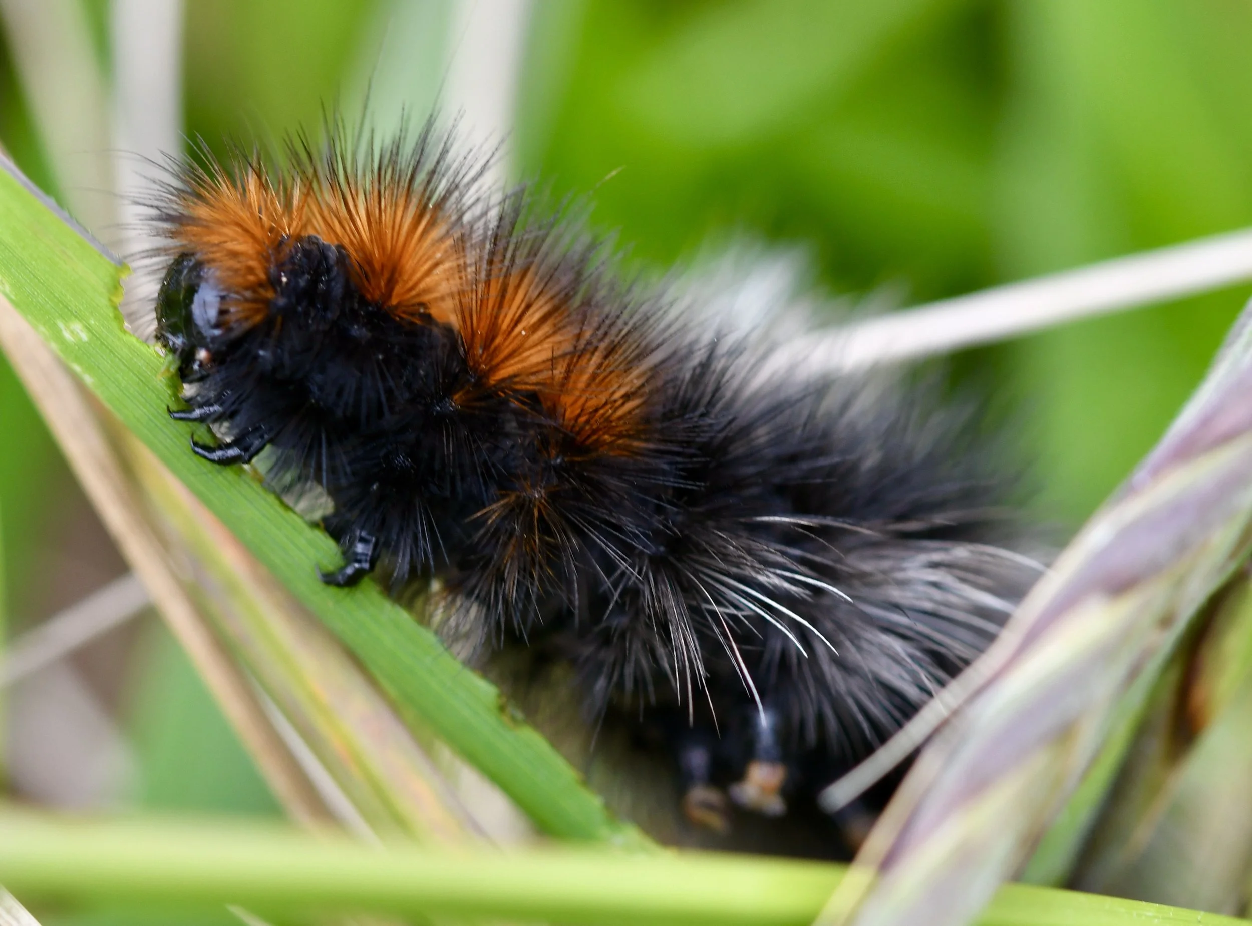

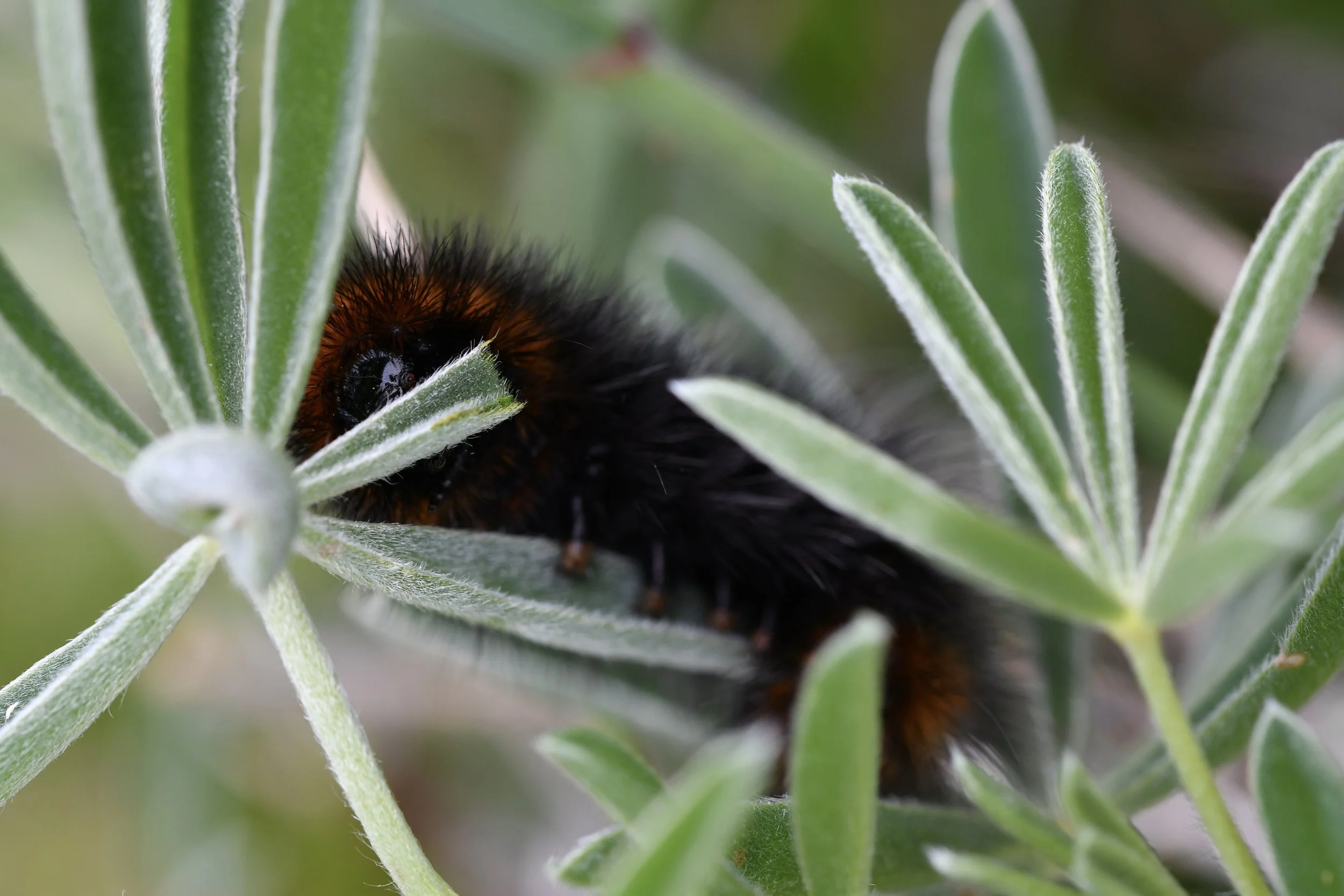
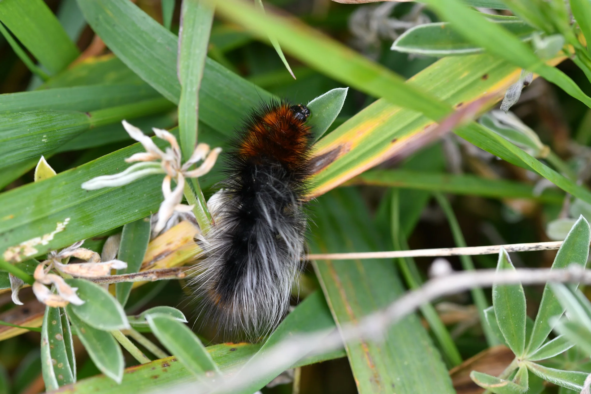
The above caterpillar, I’m fairly certain, is a species of tiger moth called “Ranchman’s tiger moth (Arctia virginalis).” Tiger moths are some of my favorites because they are beautiful as adults, and the ones I found were monching on a variety of plants: Italian thistle (Carduus pycnocephalus), Coastal Bush Lupine (Lupinus arboreus), and others unknown to me. https://www.inaturalist.org/taxa/626880-Arctia-virginalis
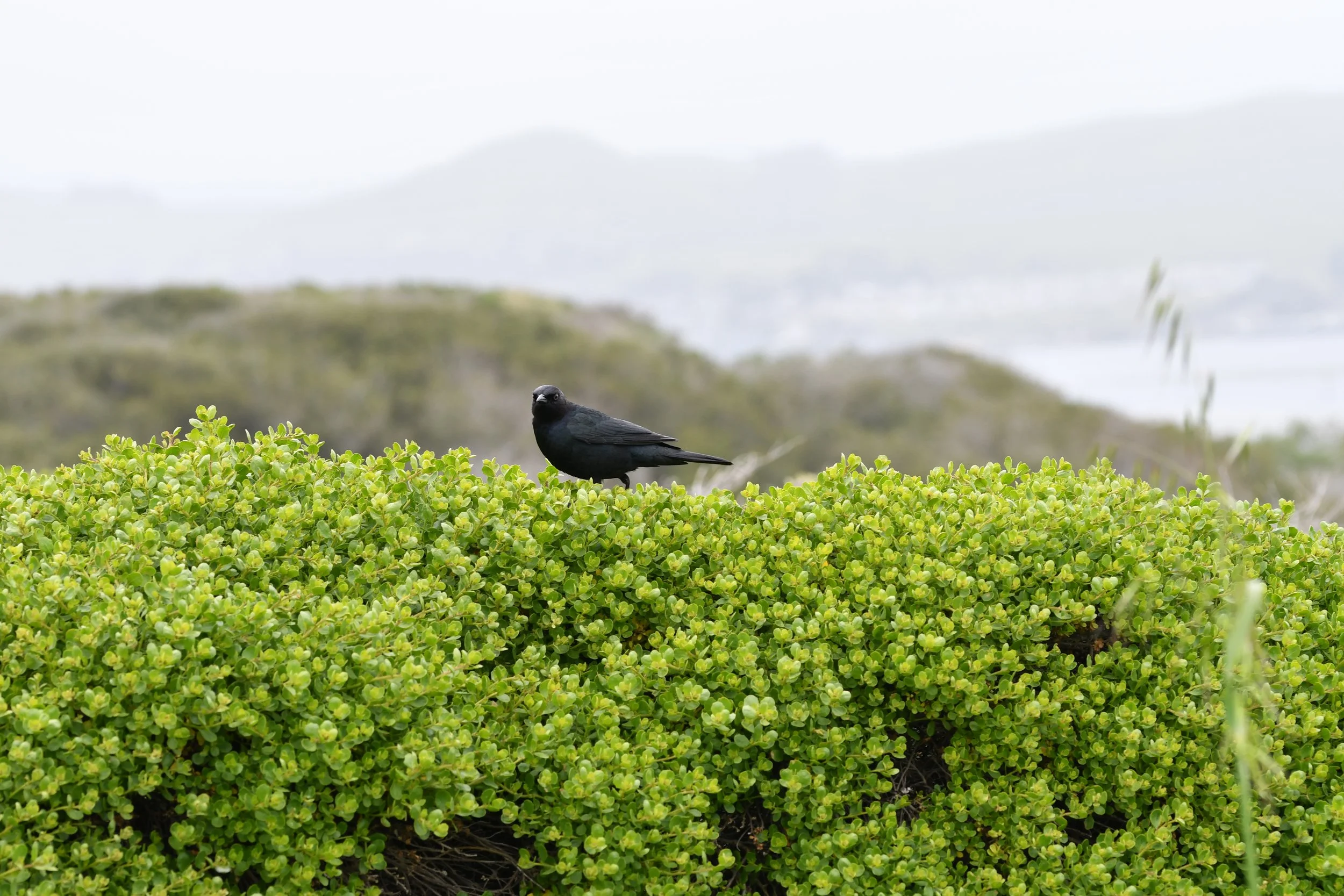
Brewer’s blackbird
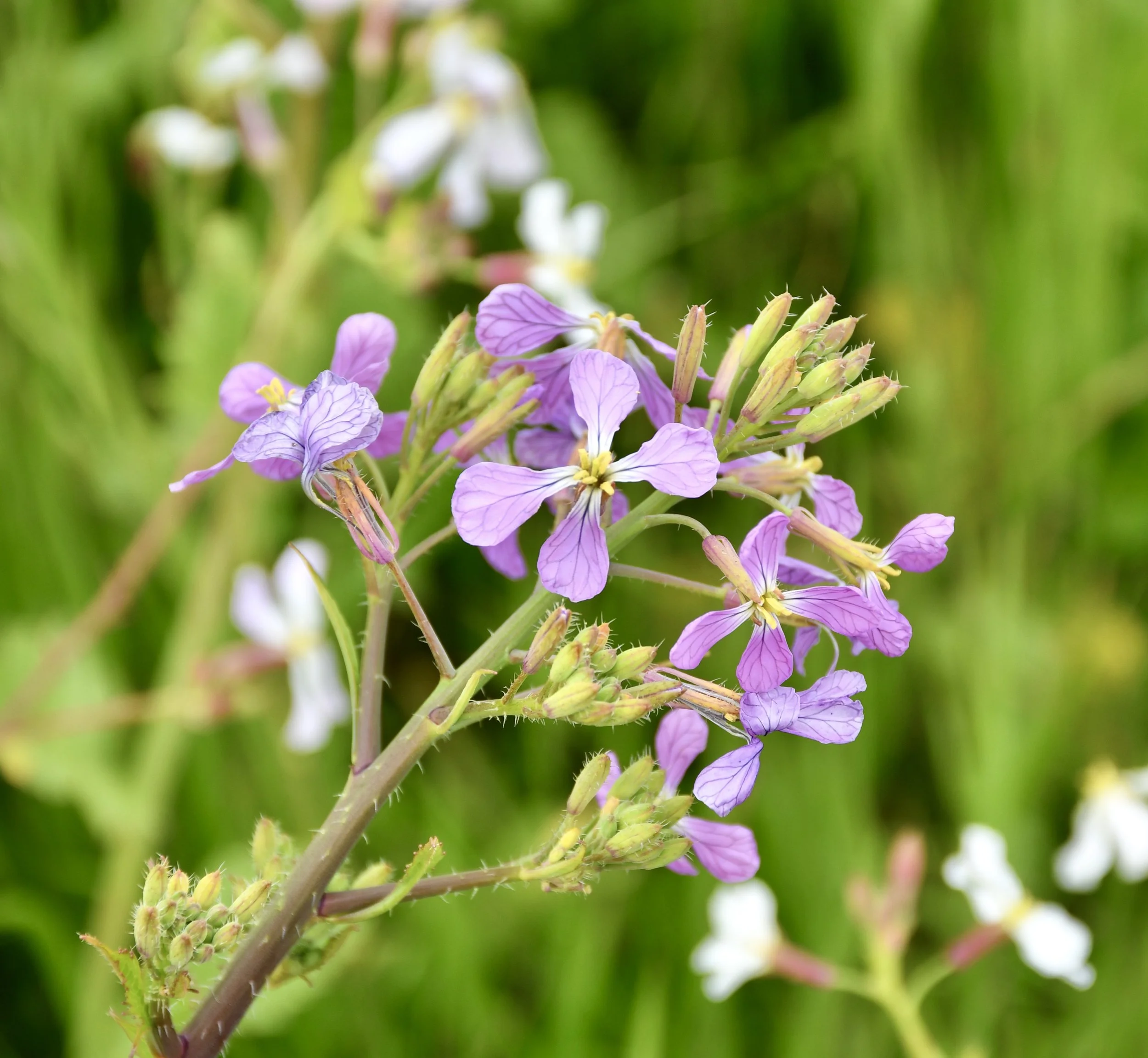
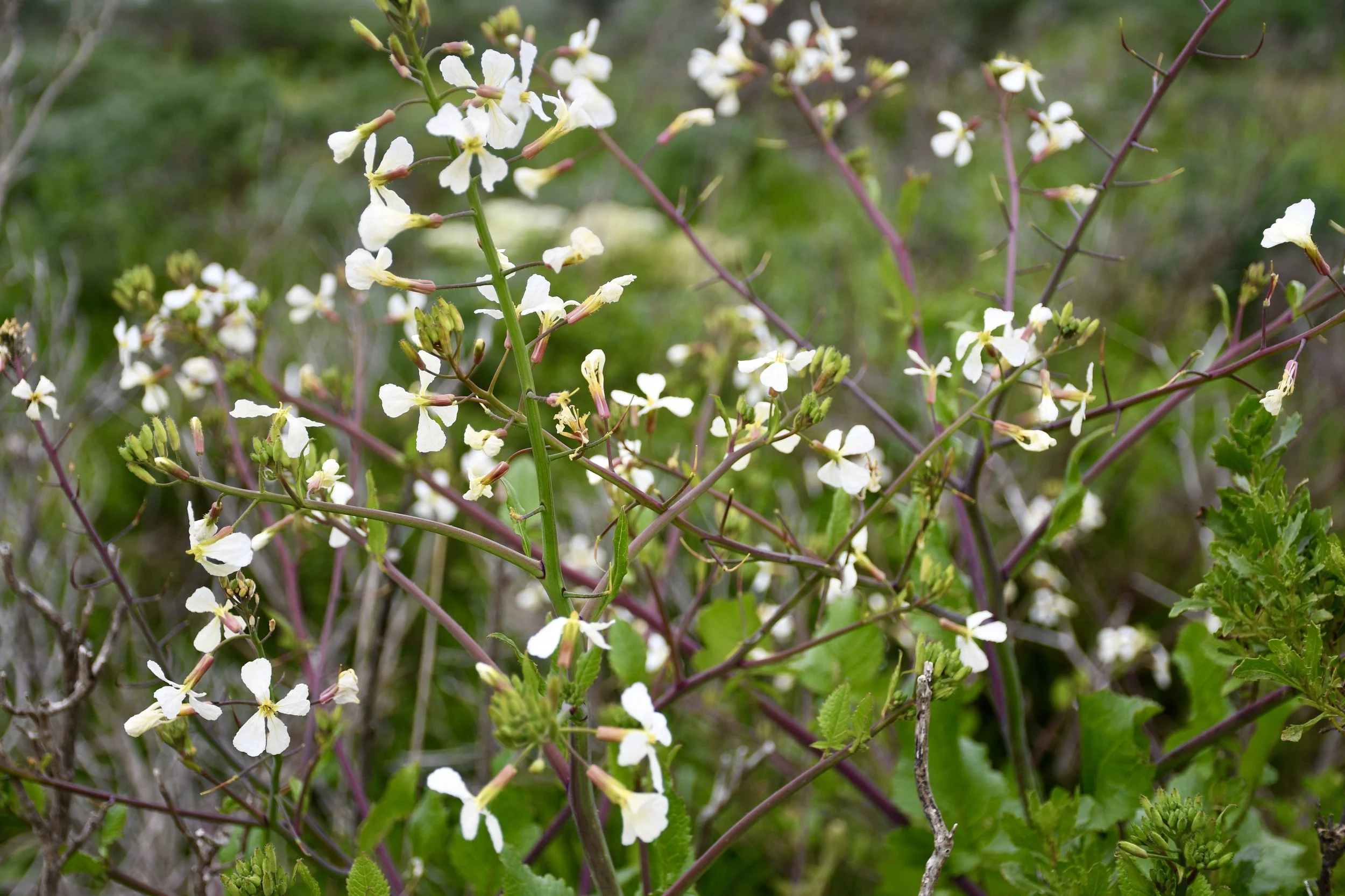
Pedal venation on wild radish
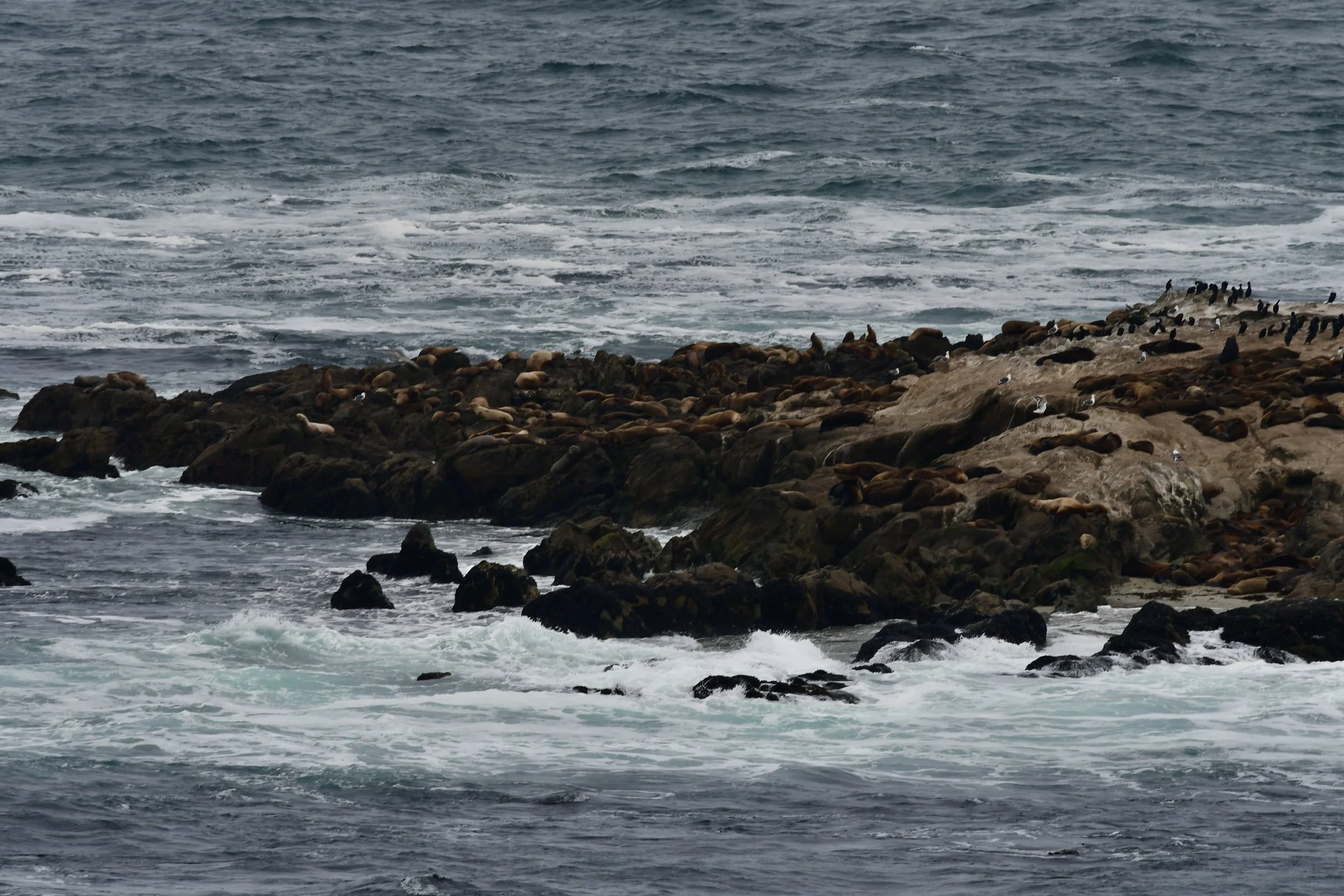
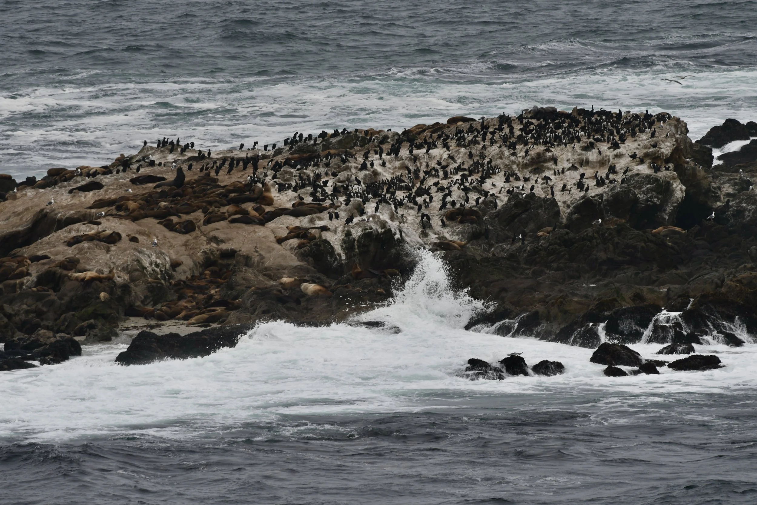

Click on each of the above images to enlarge: there are a lot of birds, yes, but don’t discount the (hundreds?) of sea lions on all of the surrounding rocks! Birds include cormorants, gulls, pelicans, and common murre’s (the ones that look like penguins)
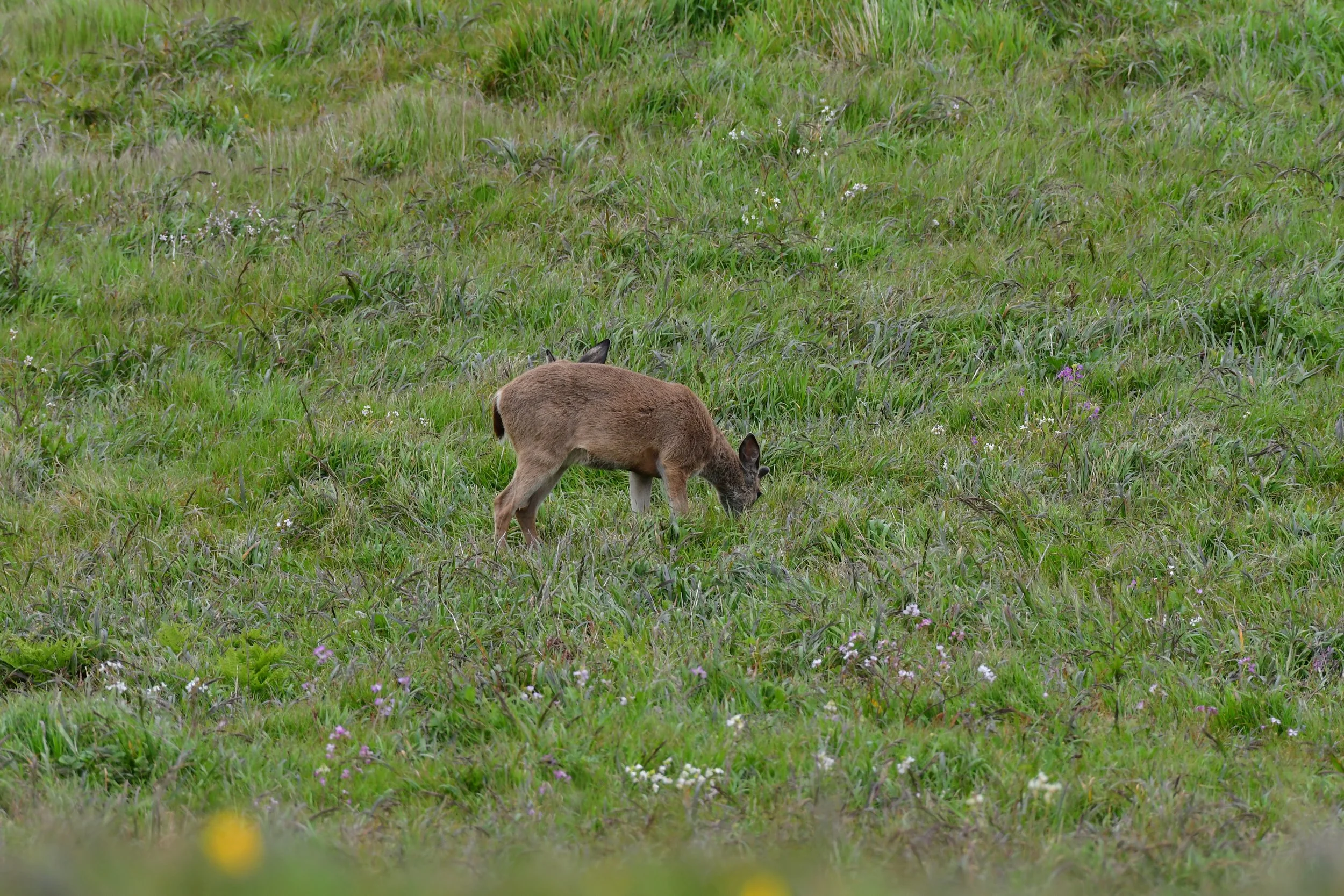

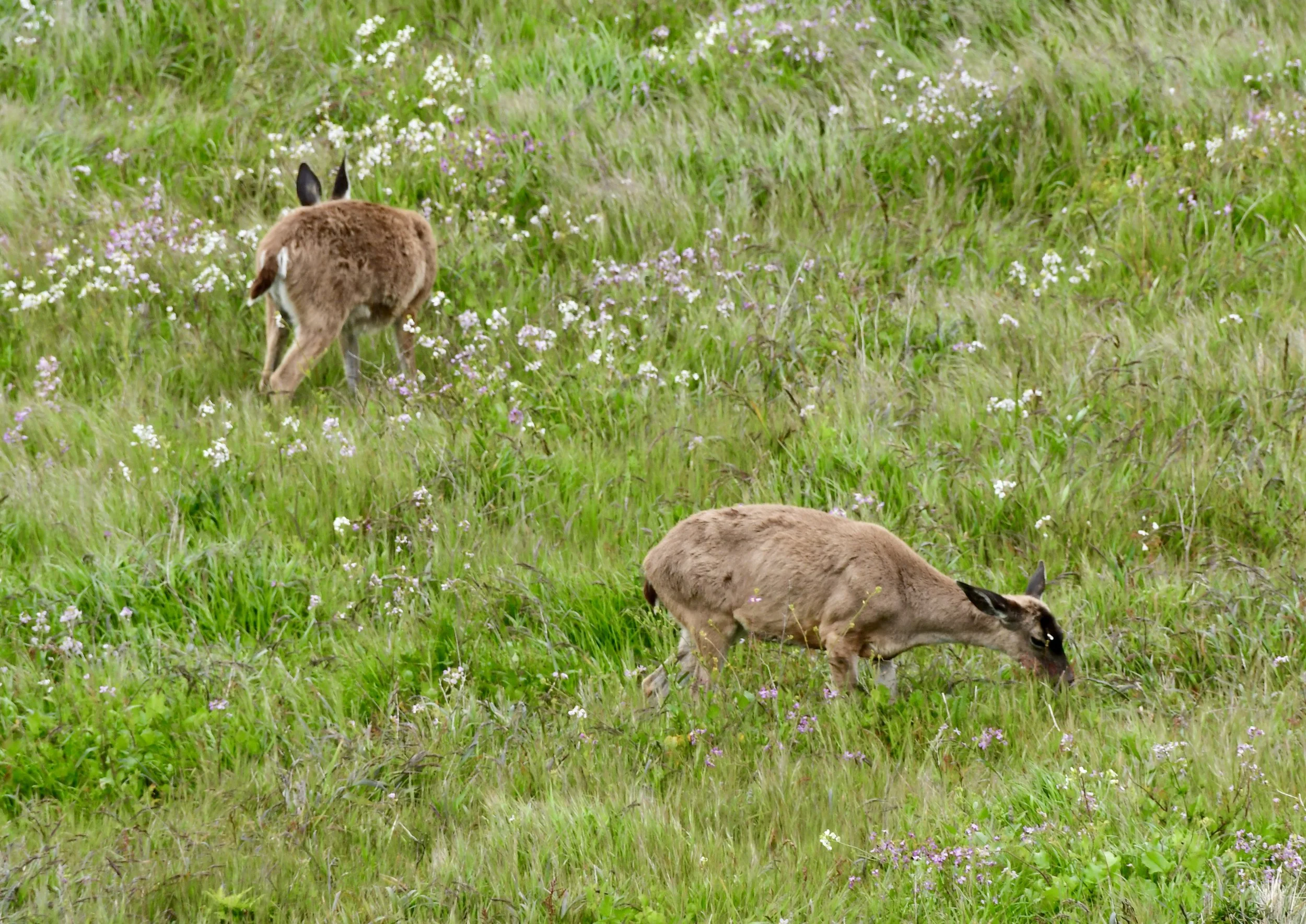
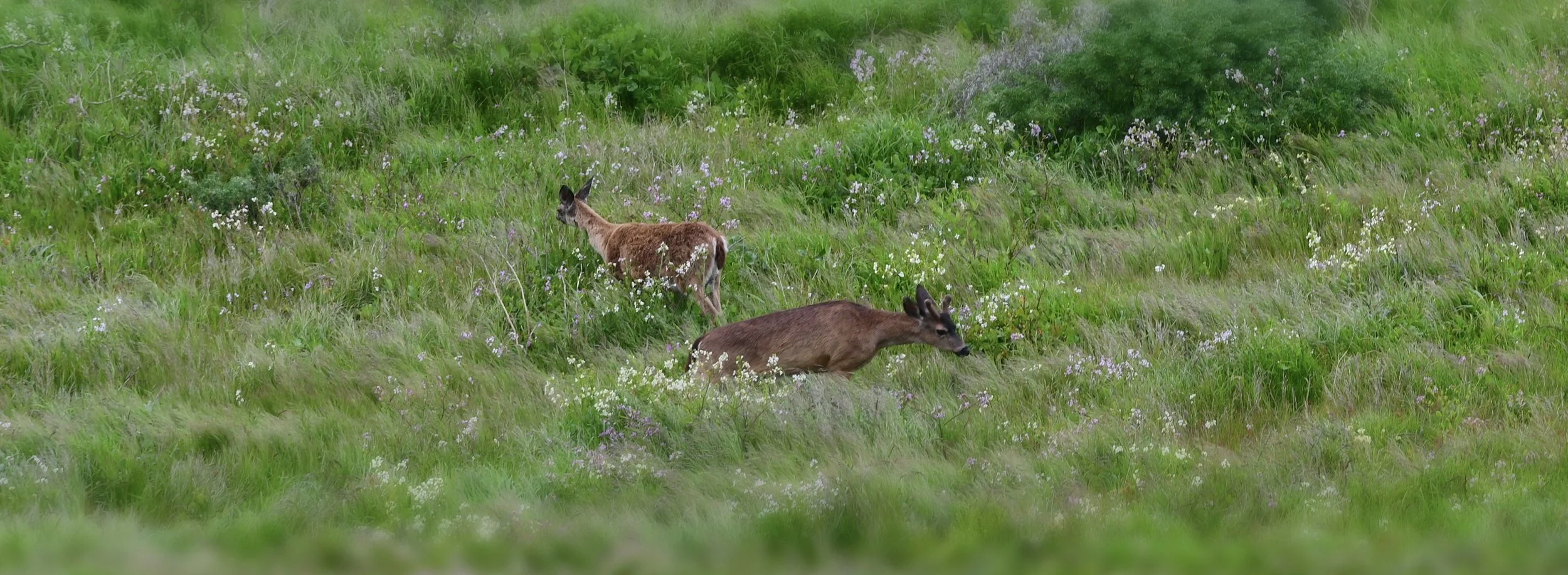
Columbian black-tailed deer


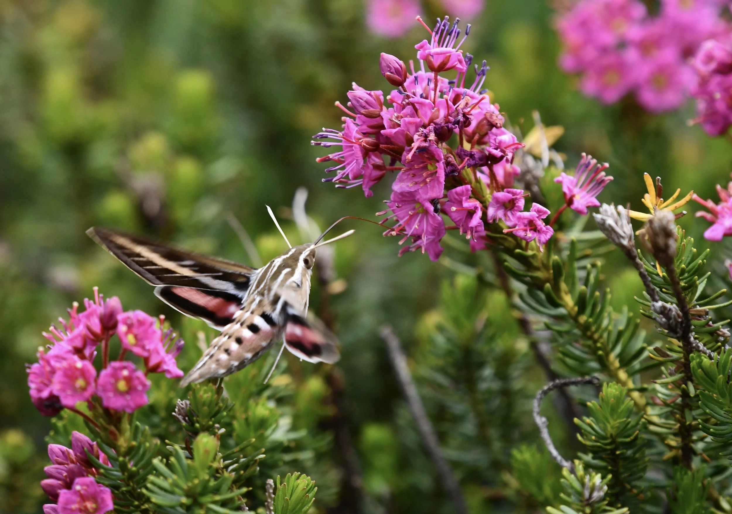
White-lined Sphinx
Hyles lineata
A beautiful, long-tongued pollinator moth often mistaken for a small hummingbird. Here, it is seen sipping on nectar from Purple Mountain Heath (Phyllodoce brewerri).


Photographs taken on the shores of Upper Granite Lake, Yosemite.

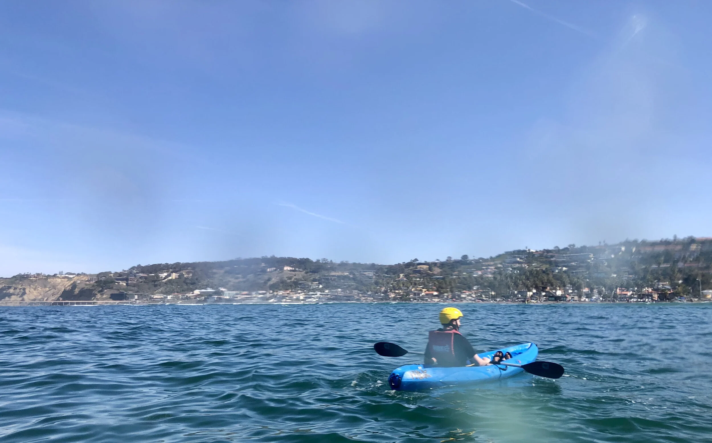
La Jolla Kayak Tours
A beautiful, sunny, blue-skied, bird-chirping, crisp-wave day. I was about to embark on my first real activity other than hiking and going to work since I moved to La Jolla in September. A taste of what the world could be (again). Before booking a tour with La Jolla Kayak tours, I checked the high tide schedule for La Jolla Cove. 9:25am. I figured since this was a sea cave tour, high tide would be the best time to go. Otherwise, it would be impossible to actually go into the caves without water in them. I booked the tour for the 10:00am slot, the first tour of the day. At 9:20am, I found one of the last available parking spot at the La Jolla Shores Beach Park (the closest parking spot without a 2 hr limit), and booked it to the place they said to meet at 9:30am. A sign on the door told me WRONG - go down the street to another place. Once there, they gave us wet suits and told us that the changing rooms were closed. Should we… put the wet suits over our clothes? Should I strip naked in the lobby? I had worn clothes that I thought would be reasonable to kayak in, not knowing the wet suit requirement. Finally, I decided to take off everything except my underwear and shimmy into the springsuit wetsuit (aka shorty, aka a wetsuit with just shorts and short sleeves - not full coverage). (I think they assume everyone knows that with a wet suit, you typically wear nothing or only a bathing suit underneath. If I hadn’t snorkeled in a wet suit in Ecuador last year, I would have had no idea.) I put on my helmet, gathered my waterproof cell phone bag with my mask, car key, ID, and credit card (they did offer lockers), and joined the rest of the crew outside… none of whom, it turned out, were wearing wetsuits. Wait, this was optional? After a few more minutes of waiting for some folks to show, we finally got down to the beach and pushed out about 40 minutes past our launch time. There were roughly ~10 kayaks in our group, some tandems, some singles (with people in them, not just lone kayaks).
I just want to say one of the coolest things upfront: when you are out on the water in La Jolla Cove, and look back to the cliffs, that you can actually see exactly where one tectonic plate is sliding underneath another tectonic plate. I am so skeptical of this because it sounds so crazy, but if our guides say it, it must be true? You can see how one of the cliff’s layers swoops downward underneath one that has horizontal layers. Nutty!
Note: most of the pictures below were taken through a layer of wet plastic:

A thing I’m learning quickly about California is that at some point when I wasn’t looking, Brazilian swimwear made it up to North America. Ass totally out I reckon is now the norm? Or if not the norm, at least acceptable. You can like, wear your ass-out bathing suit and stroll into the local convenient store next to the beach as long as you have shoes on? It’s a new, golden era.

There were tons of other kayak companies around that somehow didn’t come up in my Google search. I was actually surprised by how many people were launching boats, bumping elbows trying to get all the kayaks in and out of the ocean. Our guides were chatting it up and joking around with other guides. It also appeared we had some of the only women guides (at least at the time), Maddy (sp?) and Megan (sp?), both of whom, but especially Megan, made me laugh out loud.
The only time I had ever sea-kayaked before was in very calm waters in an inlet on the Kattegat Sea south of Gothenburg in Sweden. This was not that. There were what looked like monster waves to me (although to the surfers there, probably barely anything). As I was waiting to launch, I noticed tandem after tandem wipe out when trying to move past the waves lapping up on the shore. I was getting a little nervous. I had a single kayak. A Very Nice Man who worked for La Jolla Kayak pushed me out into the ocean as far as we both could go (well, as far as he could go), and he told me to stay straight into the waves and paddle hard. Somehow, I went up and over one, safe, up and over another, safe, then the waves spaced out and things became a little calmer.

There’s a phenomenon that happens with some regularity in my life, in which I am the first person to arrive at a destination, and so I set up shop in where I consider is a reasonable place. Then I wait and assume others will join me. Then the next person comes in and decides to set up shop somewhere else. Then the next person joins them, the next person joins them, and so on. So then by the end, all the group has congregated around the other person and I begrudgingly have to move after someone asks me “Hey, why aren’t you with the group?” Today, I was the first one out and was told that I would need to be the decider of where we congregated out in the water. I found a reasonably good, calm spot in exactly the area I was told, but then other kayakers decided to congregate further away. Cue to me having to paddle over to them and the guides.

Anyway, once we were out on the water past the shore the tour began. We paddled over ~1 mile out to the cliffs, where we learned about how all houses built along the shoreline are considered condemned (even though people still live there). The shoreline is so sandy, that it crumbles just when you touch it, and homes are very prone to sliding down into the sea. Since La Jolla Cove is a protected marine reserve, and no roads go down to the shoreline (since they can’t be built on such sandy soil), homeowners have to pay a ton of money to assess whether the home that fell off the cliff has damaged the marine reserve in some way. Also, all homeowners are required to have $2 million dollars in their bank accounts and none of their homes are insured. But, as the guides were telling us this, we could see new homes being built. As Megan said, “some people have a lot of dollars but no sense.”

Doomed $10 million homes along the seashore.
It was a beautiful view of the cliffs with hundreds (perhaps thousands) of cormorants among them, along with seagulls and pelicans. Unfortunately, we did not go into the seacaves. As it turned out, the caves were not a part of this tour, high tide be darned. Further, because the tide was so high, we weren’t able to see any of the kelp forests. My clever plan had backfired. Another sign from the universe telling me that I should stop trying to prepare so much? That foresight is dumb? Good lesson, universe. I’ll try that next time and let you all know how it goes.

Some other cool cormorant facts (that I still need to fact-check): apparently they dive on one side of their face so furiously to catch fish that over time, they become blind in one eye. Then they start favoring the other side of their face, so they eventually become blind in both eyes. Then they hang out at the cliffs waiting to die. They can apparently dive like 150 feet into the water? And their bones are really dense so it’s hard for them to take off in flight. Pelicans, on the other hand, fly up to 25 mph into the water but only go about 2 feet deep to catch fish. Maddie claimed that this was the case, but Megan wasn’t buying it. On our paddle back to shore, we passed another guide. The conversation went something like:
Megan: “Hey man, how deep can pelicans dive?”
Other guide: “Hella deep.”
Megan: “Nuh-uh!”
So, the jury is still out on that one.

So, we did see a ton of cool cormorants, learned about the diving board that used to jut out over the ocean (no longer present, probably the removal of which has saved many lives). Also apparently sea lions were introduced to La Jolla quite recently to try to control the urchin population, which (of course) did not work, and now instead they eat a lot of native fish that are dwindling dangerously in numbers. Turns out the sea lions are a kind of pests, but they have cute babies, so they’re here to stay.
The coolest part of the trip was on the way back. All of a sudden, probably 20-30 feet away, 2 dolphins poked their heads out and we could see almost their whole bodies glide into and out of the water. I heard a stand-up-paddleboarder say, “Those were the teenagers, the whole family is up on ahead a little bit and they’re kind of straggling and doing their own thing.”
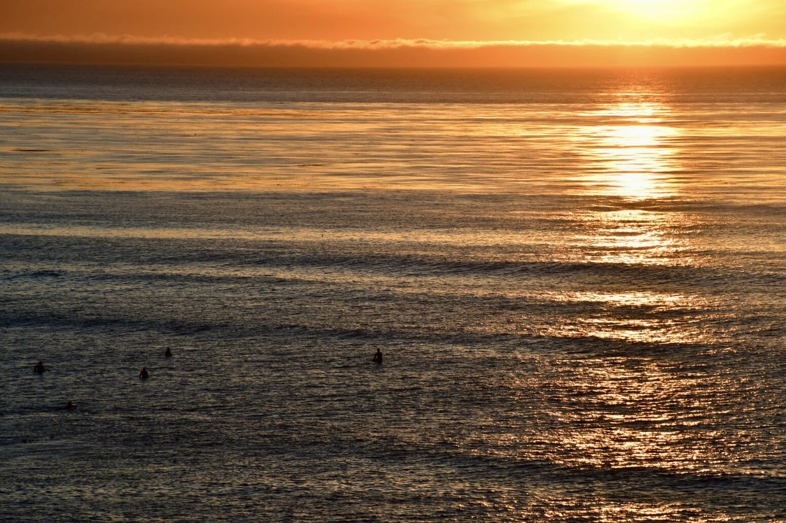
Then, oh god, getting back into shore. They told us if we got caught on a wave, to just paddle as fast as we could straight toward the shore, and lean back and make our bodies as flat as possible. Right when I went in, I somehow was on the crest of the biggest wave. My strength was no match for it. I went way up then was slammed down, getting totally drenched. The boat veered sideways but didn't flip. I rode the wave as it took me to shore, but then another one came right after and the same thing happened again. There was no way I could have kept the boat straight, and it pushed my 30-40 feet up the shore away from the other boats. I was shaking with adrenaline. Is that what surfing is like? It’s kind of terrifying. I pulled my boat up to the shore, happy to have been wearing the springsuit.
One thing you don’t want to see after having spent hours in the water is this sign:

Something our guides said nothing about. Is this also supposed to be common knowledge? Of course, tons of people swim, kayak, stand-up-paddleboard, surf, and fish in La Jolla Cove. The marine reserve that we kayaked atop of is apparently the 2nd most biodiversity reserve on the West coast (the first being Monterrey Bay). Pretty startling that the levels of “bad” bacteria are so high, that is advised to not swim IN A RESERVE.
This is important and worthy of further exploration, so until next time!, when I write more about the actual reserve and the bacterial issues here.
And, for those curious, here is more information about La Jolla Kayaking Tours: https://www.lajollakayak.com
Specifically, I booked the “Original Kayak Tour.” Don’t let the picture of going inside the caves deceive you like they did me :(


Sunset Cliffs Natural Park
"Create a park where people can enjoy San Diego's natural coastal environment as it once was, free from the effects of man and intended to inspire the user to reflect on the grandeur of the sea, and the beauty of the cliffs that was once Point Loma." - sandiego.gov


Blue Sky and Lake Poway
I spend a lot of time sitting in my apartment. In particular, I have a nice squishy chair and couch that I sink into. But after a while, I start getting antsy and full of cabin fever.
This pandemic has been rough. Moving to an entirely new city and state where I don’t really know anyone is rough. What has been my absolute saving grace is the beautiful, sunny weather and the ability to move my limbs in it. As soon as I get out onto a trail, I feel like some energy can finally be released. My isolation and confinement melt away, and I can begin to appreciate being immersed in nature, moving through it, and documenting it. I feel for everyone who is isolated in much more inclement conditions.
I have been telling myself that I would buy a camera as my first major purchase once I started getting a paycheck again (after all the rent, food, other essentials, of course). A little crazy, I know, but I DID IT. A sleek Nikon D7500 that I have been having a lot of fun playing with. There is still so much about it that I don’t know yet, but being outdoors and trying different settings has given me a perfect excuse to be completely immersed in something other than work.
The Blue Sky Ecological Reserve was a great place to capture some shots last weekend. Also, as a side-note, I’m still not clear on the differences between a preserve and a reserve, although it seems that outside of the US, “reserve” is used in place of “preserve.” Blue Sky is about 700 acres set aside to protect riparian vegetation, and since mountain bikes and motorized vehicles are banned, there are a lot of wildlife.


Green Valley Truck Trail

Acorn woodpeckers working away on a dead tree.


Side-blotched lizard.

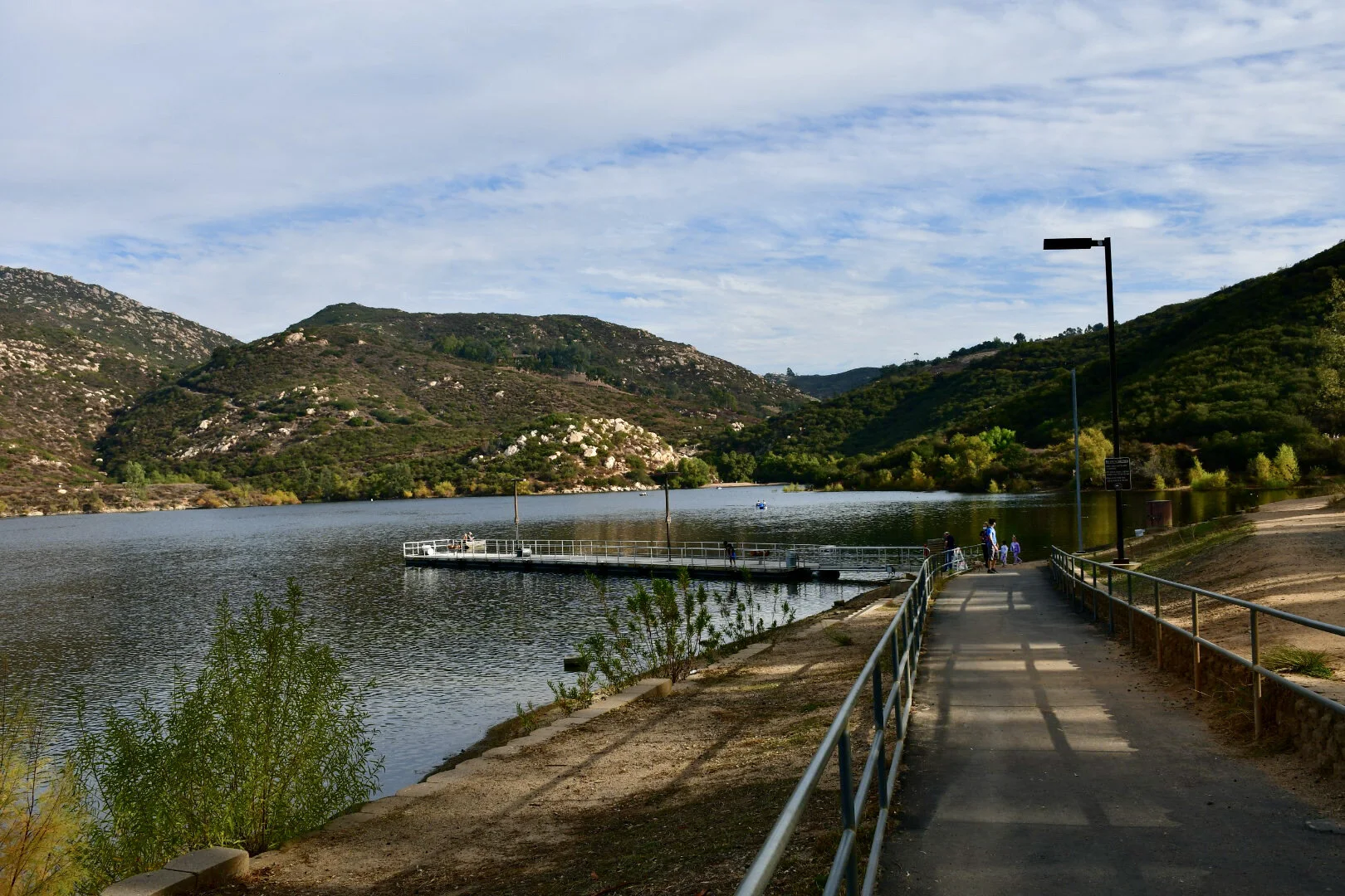
The Lake Poway dam. On the other side, from the bottom, it looks like a momentous rock wall.

Lake Poway. So many American coots and mallards (and people) (and dogs!). This is the main water supply for the city of Poway, California.

Black phoebe

A view from the other side of the lake.

Buzz buzz honey bees!

Cormorants!

Outdoor exploration refreshes the soul.

Tijuana River Slough and Estuary
The Tijuana River Estuary is the southwestern most part of San Diego County, of California, and of the entire United States. It shoulders up to the border wall separating Mexico and the United States. If you search on Google Maps, you can even see where the border wall extends way out into the ocean, and happens to be in an area with rip currents and dangerous swimming conditions, though I am sure many people have tried to swim from Mexico to the US or vice versa. It is a beautiful area, and one of those fascinating spaces where you can see the delineation between the countries so clearly. It also happens to be an essential stopover area for many bird species traveling all along the west coast - in some cases, all the way from Canada down to Peru, as in the case of the Elegant Tern.

Facing South. Trail leading out to the marshlands, an excellent place for birdwatching. On top of the hill in the distance is the border wall.

Over 370 species of birds have been recorded here!


Tree swallow (Tachycineta bicolor).

A sewage pipe used to lay across these wooden stands and extend all the way to the ocean.

California fuchsia (Epilobium canum), a species of willowherb native to California.


Whimbrels! (Numenius phaeopus) In spring, these birds fly all the way to northern Alaska to breed.

Snowy plovers (Charadrius nivosus) in flight.


Snowy egret (Egretta thula)


The best part of the hike may have been the cat a couple was carrying in a clear backpack with a little hole where it’s head could stick out. Good kitty!

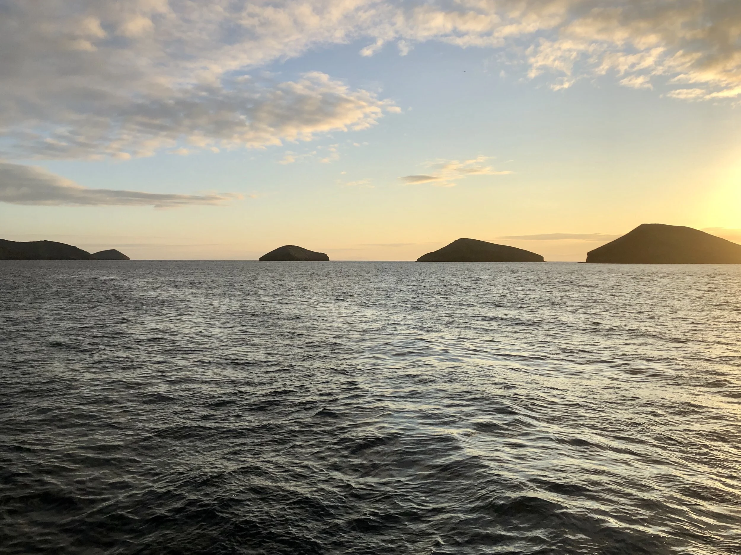
Archipel II
The Galápagos is one of those places that in order to do it right, you really need to find a good boat. There are so many nooks and crannies and places that you can’t reach unless you have pangas to get you on shore. And of course, many of the islands have no towns, roads, or modern habitat-destroying conveniences. We were incredibly lucky on board the Archipel II. The group of tourists were all friendly and talkative, and the crew (though most of them knew very little English), still managed to make me laugh, and were very accommodating. And the FOOD was delicious. Sad to say but happy to report that I ate more vegetables there than I had in the past 6 months of my life. Today’s post is a little tribute to the catamaran that was my home for a week (with a few repeat photos from the first Galápagos blog post).


bonbon treats on my bed!


When I returned, my glasses had sprouted a towel in the shape of a ray! And some chocolates for eyes. I absolutely loved seeing this after coming back sweaty and tired.

Our dining area and wet suits hanging up to dry on the deck.


Another masterpiece!

Someone is very good at making sculptures of animals out of everyday objects!


Napping on the deck.

release the pangas!


Again, thank again to an excellent crew! Salud!

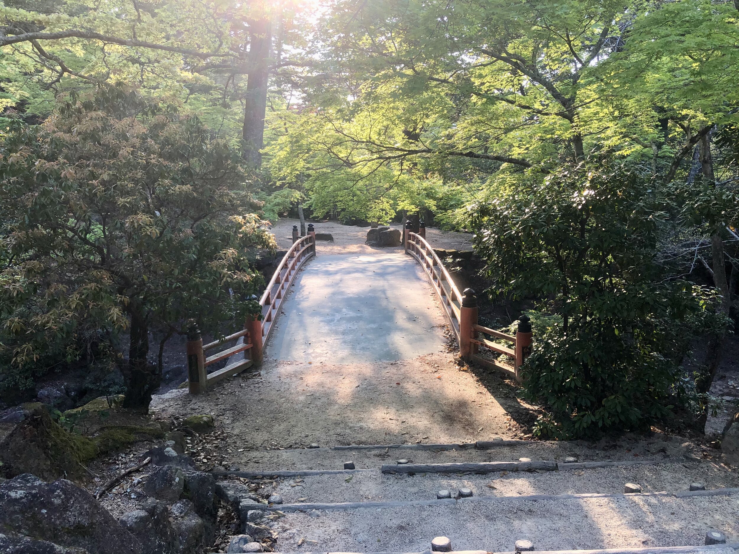
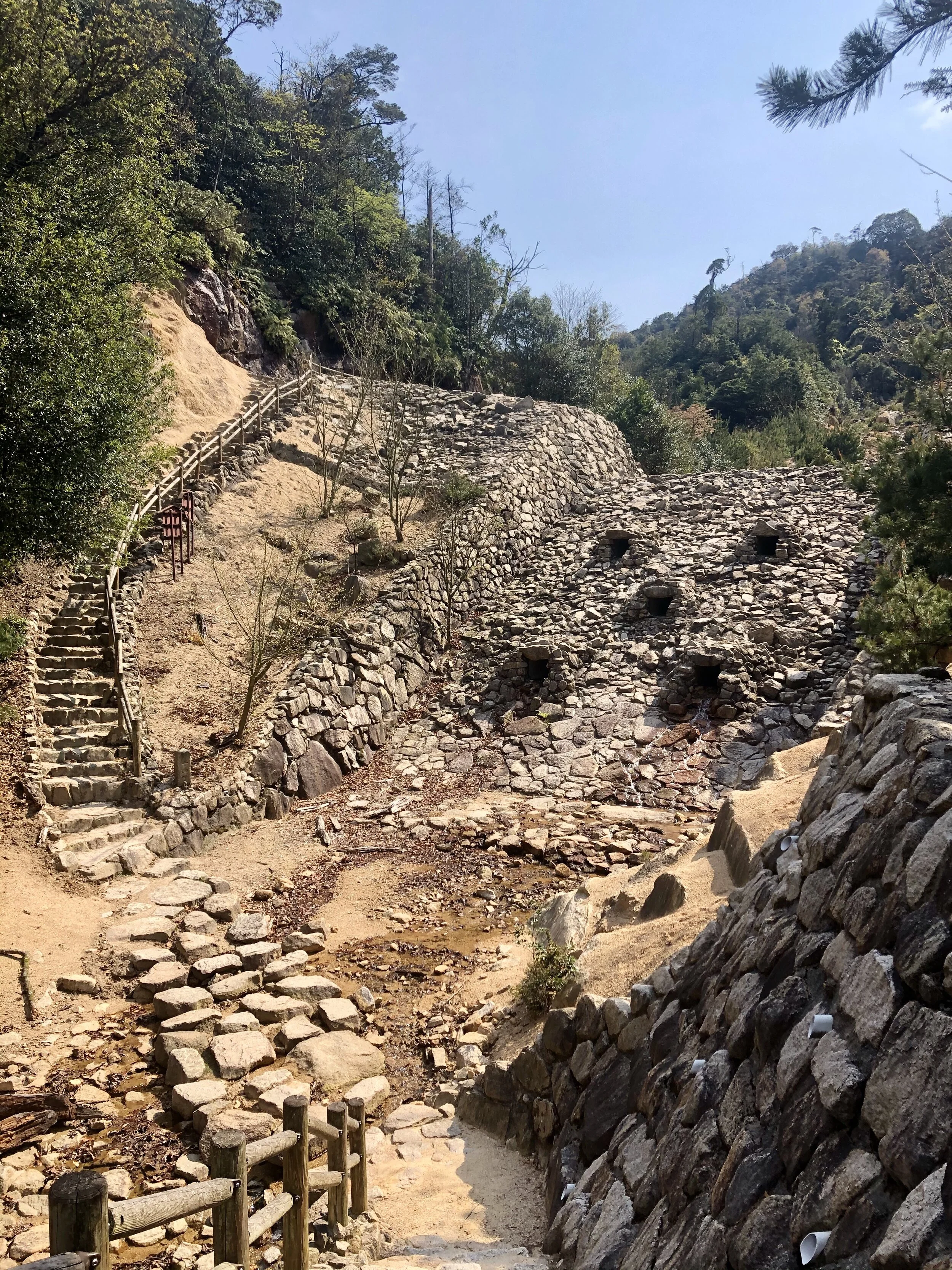
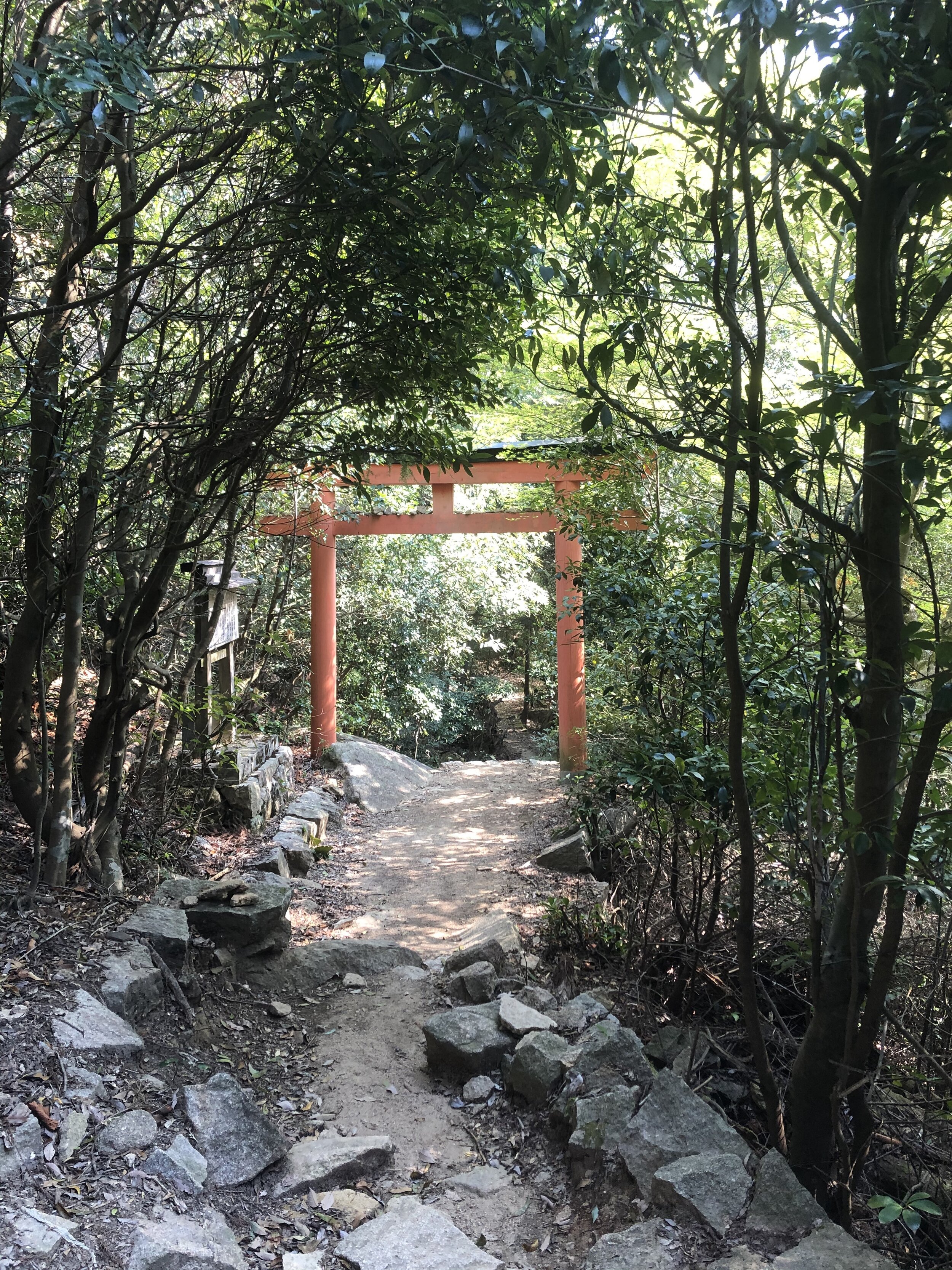
Miyajima’s Mt. Misen
Climbing Mt. Misen was a great excuse to get out of the Airbnb, and although scrambling up to the top of a mountain has left me sore and stiff, it was worth it for the views and fresh air. Mt. Misen is on the island of Itsukushima, otherwise known as Miyajima. It’s about a 45-minute train right southwest of Hiroshima and then another 10 minutes on the ferry. Luckily, public transportation is still running, albeit on a reduced schedule.


Fortunately, I didn’t see one! Unfortunately, I didn’t see one. :(

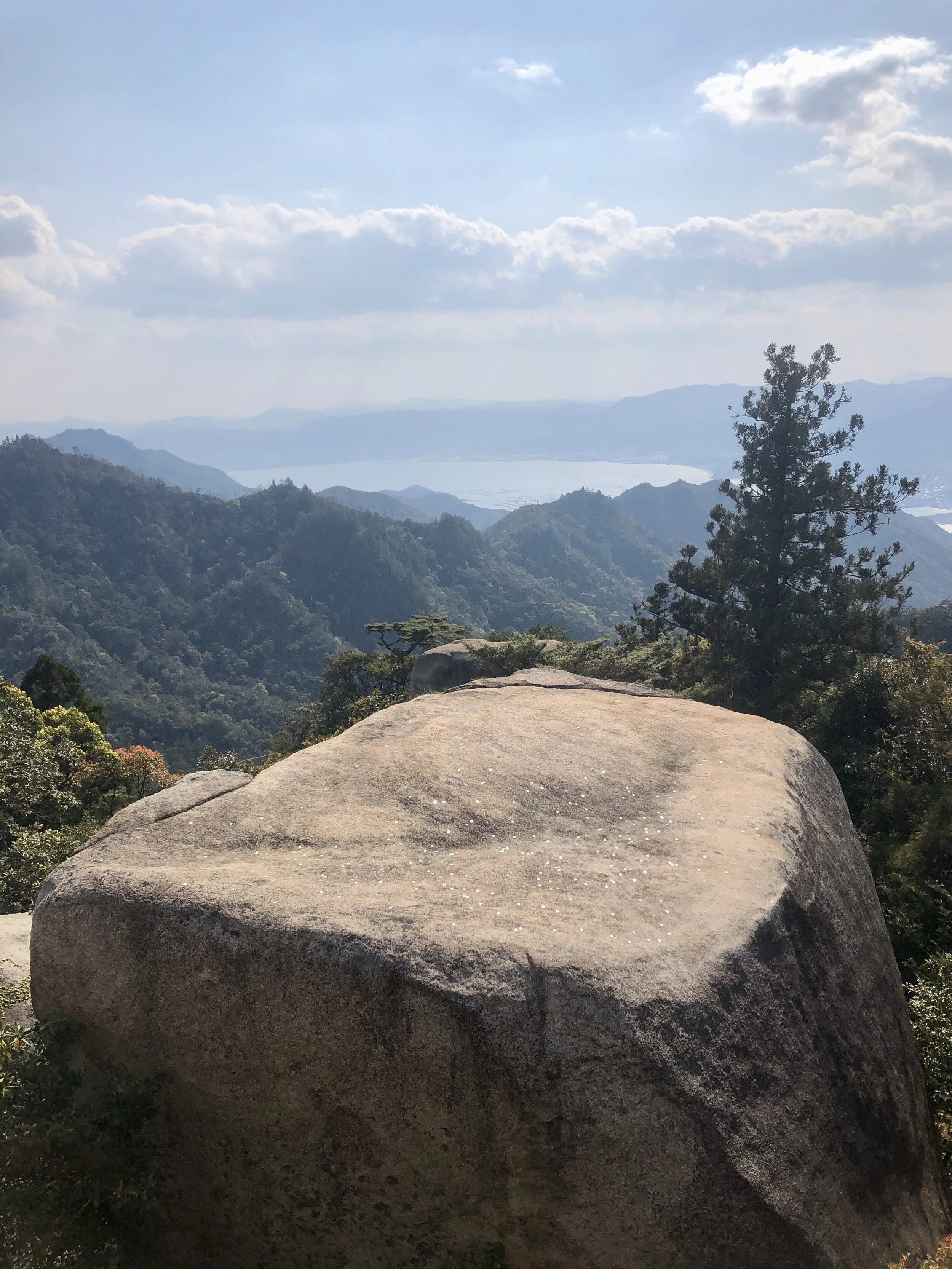
up and up and up

the first glimpse of a lookout


We meet again, googly eyes!


Do you see the little buddha in the above picture? Almost exactly center frame.


the shiny things on the rock are coins!