
Heaphy Track: Part II
Day 3: James Mackay Hut to Heaphy Hut


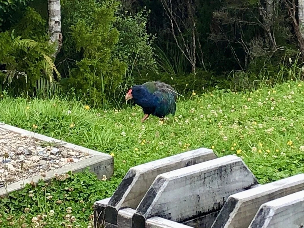
Okay SO. This bird is exciting. It is called a takahē (Porphyrio hochstetteri) and looks sort of like a very large colorful chicken with a bright red beak (this was as close as I could get to one, so the image quality isn’t great). They are flightless birds, so once again, have little precaution against humans or human-introduced predators. In the late 1800s the “last” one was caught. They were presumed to be extinct for 50 YEARS until in 1948, a local man out for a tramp (see definition in previous post) stumbled upon one in the wild. Can you imagine being that dude? It would be like seeing a unicorn. After its rediscovery (future searchers found 2 birds), the part of Fiordland park in which they were found was closed off to people in order for the takahē numbers to rebound. Unfortunately, by the 1980s, their numbers were still only a little over 100. The DoC intervened with targeted breeding programs (located at Te Anua, which I will be visiting next week!) and the population has now increased to about 400 individuals. In 2018, 30 adult takahēs were introduced near the Heaphy Track in Kahurangi National Park (specifically Gouland Downs, where this photo was taken). This past week, on the track itself, I saw 5 of them!!! That’s 1/6 of the whole population!! This is the first wild population outside the remote Fiordland Murchison Mountains where they were originally rediscovered. All 30 birds are closely monitored and only one has died of natural causes. Next step will be to see how the breeding and survival rate of chicks goes! If it is successful, it will be major.
Damn. Now that’s a conservation story.
Read more here: Wild takahē return to Kahurangi National Park


And finally, the view from the Heaphy Hut!

Where the Heaphy River meets the ocean.
Day 4: Heaphy Hut to Kohaihai River Mouth (16.2 km) and the disintegration of my character (distance unknown)

Day 4 was spent entirely along the Pacific coast, but this is the day I finally broke. What should have taken 5 hours to finish took nearly 7, and my bent-over dry-heaving on the trail caused alarm in some fellow trampers, who alerted a park ranger who came and literally carried my backpack the rest of the way (maybe 2 kms). Ashamed? Yes. Relieved? YES. Made it to the bus on time? YES!
I’m not sure what did me in. I don’t think it was water contamination. It was probably overexertion from carrying a bag with all my worldly possessions plus a lack of sufficient calories that created a problem I have experienced as well in my last 2 trail runs (though calories weren’t the issue there, I don’t think, nor was the pack). Who knows? Something to keep an eye on.
But look at these views!


The end is nigh!